-
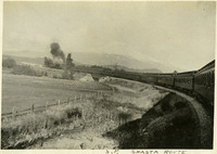 McCarthy Album 03, Photograph 066
 Caption: "S.P. Shasta Route." Southern Pacific train on the Shasta route with Mt. Shasta in the background, c. 1905.
-
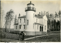 McCarthy Album 03, Photograph 065
 Caption: "Fort Casey Light House, Wash." c. 1905. Located on Whidbey Island in Puget Sound, the Admiralty Head Lighthouse was built overlooking Admiralty Inlet in 1903. It replaced an earlier structure that had to be moved in 1890 to accommodate the construction of Fort Casey. The second lighthouse, shown here, was built with thick walls in order to withstand earthquakes and the concussion of guns at Fort Casey. The man shown in the photograph is likely Charles H. Davis, who was appointed keeper of the lighthouse in 1900 and served until his death in 1914. The lighthouse, deactivated in 1922, has since been restored by Washington State Parks, and is part of the Fort Casey State Park.
-
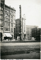 McCarthy Album 03, Photograph 064
 Caption: "Totem Pole, Seattle." Seattle, Washington, c. 1905. View of the Tlingit totem pole in Seattle's Pioneer Square. The totem pole was stolen in 1899 by a group of businessmen, and erected in the square, then known as Pioneer Place. An arsonist destroyed this pole in 1938, but it was later replaced by another carved by the Tlingit tribe (who were also finally paid for the original pole).
-
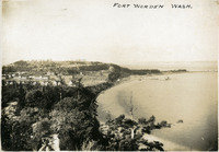 McCarthy Album 03, Photograph 063
 Caption: "Fort Worden, Wash." Washington, c. 1908.Construction of Fort Worden in Port Townsend, Washington, on Admiralty Inlet of Puget Sound began in 1898, and by 1902 it was serving as an active U.S. Army base. Fort Worden was part of the "triangle of fire", three coastal defense fortifications (Fort Casey, Fort Worden, and Fort Flagler) guarding the entrance to Puget Sound. The U.S. sold the property to the state of Washington in 1957. In 1973, the fort and surrounding area opened as Fort Worden State Park.
-
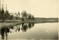 McCarthy Album 03, Photograph 062
 Caption: "Fort Casey Lake," Washington, c. 1908. Peaceful scene at Crockett Lake near Fort Casey, the water so still that the trees and surrounding hills are clearly reflected in the lake's waters.
-
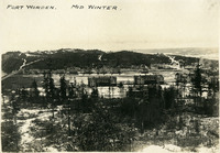 McCarthy Album 03, Photograph 061
 Caption: "Fort Worden. Mid Winter." Construction of Fort Worden in Port Townsend, Washington, on Admiralty Inlet of Puget Sound began in 1898, and by 1902 it was serving as an active U.S. Army base. Fort Worden was part of the "triangle of fire", three coastal defense fortifications (Fort Casey, Fort Worden, and Fort Flagler) guarding the entrance to Puget Sound. The U.S. sold the property to the state of Washington in 1957. In 1973, the fort and surrounding area opened as Fort Worden State Park.
-
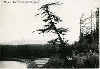 McCarthy Album 03, Photograph 060
 Caption: "Port Townsend Beach," Washington, c. 1909.
-
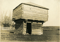 McCarthy Album 03, Photograph 059
 Caption: " Block House, Fort Casey. Used in Early Days as Protection Against the Indians." Washington, c. 1909. View of a blockhouse, a timber structure built by European settlers to guard against attack during the Indian Wars of 1855-1857.
-
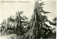 McCarthy Album 03, Photograph 058
 Caption: "Frozen Trees. Pt Townsend," Washington, c. 1909.
-
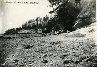 McCarthy Album 03, Photograph 057
 Caption: "Fort Flagler Beach," Washington, c. 1909.
-
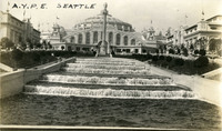 McCarthy Album 03, Photograph 056
 Caption: "A.Y.P.E. Seattle." Cascading fountains at the Alaska-Yukon-Pacific Exposition. The Alaska-Yukon-Pacific Exposition was held in Seattle, Washington in 1909 to celebrate the development of the Pacific Northwest. The fair attracted 3.7 million visitors over the course of its run from June to October 1909. Although most of the fair's buildings have since been destroyed, several of them now serve as part of the University of Washington campus.
-
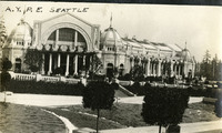 McCarthy Album 03, Photograph 055
 Caption: "A.Y.P.E. Seattle." Exposition building at the Alaska-Yukon-Pacific Exposition. The Alaska-Yukon-Pacific Exposition was held in Seattle, Washington in 1909 to celebrate the development of the Pacific Northwest. The fair attracted 3.7 million visitors over the course of its run from June to October 1909. Although most of the fair's buildings have since been destroyed, several of them now serve as part of the University of Washington campus.
-
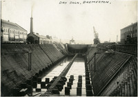 McCarthy Album 03, Photograph 054
 Caption: "Dry Dock, Bremerton." Bremerton, Washington, c. 1908-1912. See also 96-07-08-alb08-085. View of a dry dock at the Puget Sound Naval Shipyard in Bremerton, Washington. Established in 1891 as a naval station, it became Naval Yard Puget Sound in 1901. During World War I the shipyard constructed hundreds of ships to support the war effort, while in World War II, the shipyard was dedicated primarily to repairing damaged ships. Today, it contains a portion of the U.S. Navy's mothball fleet (ships retired but retained in case of future need), as well as building, repairing, and maintaining sea-going vessels of all kinds.
-
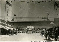 McCarthy Album 03, Photograph 053
 Caption: "A.Y.P.E. Entrance." See also 96-07-08-alb08-121. The Alaska-Yukon-Pacific Exposition was held in Seattle, Washington in 1909 to celebrate the development of the Pacific Northwest. The fair attracted 3.7 million visitors over the course of its run from June to October 1909. Although most of the fair's buildings have since been destroyed, several of them now serve as part of the University of Washington campus.
-
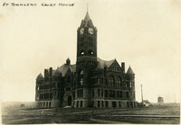 McCarthy Album 03, Photograph 052
 Caption: "Pt. Townsend Court House," Washington, c. 1908. See also 96-07-08-alb08-033. View of the Jefferson County Courthouse in Port Townsend, Washington. Built the early 1890s (W.A. Ritchie, architect), the Romanesque-style building features a 124-foot clock tower, red bricks from St. Louis, and sandstone from Alaska.
-
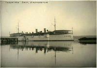 McCarthy Album 03, Photograph 051
 Caption: "Training Ship. Bremerton," Washington, c. 1908 - 1912. See also 96-07-08-alb08-086. View of the USS Philadelphia (C-4). The fourth ship to bear the name, the Philadelphia first launched in September 1889. She sailed as part of the U.S. Navy's Atlantic Squadron until 1893. She then sailed into the Pacific Ocean, where she served until being decommissioned and docked in Puget Sound in 1902. In 1904, the Navy "housed over" the ship (adding the roofed quarters visible on the upper deck in the photograph) and designated her a receiving ship for new sailors not yet assigned to a crew. The Philadelphia served in this capacity until 1912. After a brief stint as a prison ship, the Philadelphia again became a receiving ship in 1916. The Navy sold her in 1927.
-
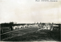 McCarthy Album 03, Photograph 050
 Caption: "Fort Stevens, Oregon," c. 1905. Panorama of Fort Stevens, built in the 1860s as part of the defensive fortifications guarding the mouth of the Columbia River. Located on the Oregon side of the river, the fort was decommissioned after World War II, its armaments and buildings removed and auctioned off. The site now serves as a state park complete with military museum.
-
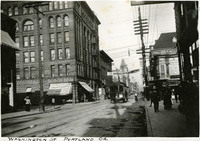 McCarthy Album 03, Photograph 049
 Caption: "Washington Street, Portland, Oregon," c. 1905. A street scene with electric car, several storefronts, and pedestrians milling about.
-
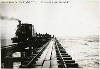 McCarthy Album 03, Photograph 048
 Caption: "Building the Jetty, Columbia River," c. 1905.
-
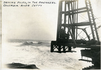 McCarthy Album 03, Photograph 047
 Caption: "Driving Piles in the Breakers, Columbia River Jetty." c. 1905.
-
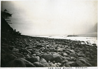 McCarthy Album 03, Photograph 046
 Caption: " Seaside Beach, Oregon," c. 1905.
-
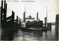 McCarthy Album 03, Photograph 045
 Caption: "N.P. Ferry. Columbia River." See also 96-07-08-alb08-114 with caption: "Ferry Boat Tacoma on the Columbia River," Pacific Northwest, c. 1905. View of the railroad ferry Tacoma, with a train on board. The Tacoma operated from 1884 until 1908, when a railroad bridge was constructed across the Columbia connecting Portland, Oregon with points north of the river.
-
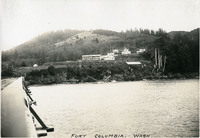 McCarthy Album 03, Photograph 044
 Caption: "Fort Columbia, Wash." Washington, c. 1909.
-
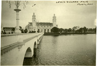 McCarthy Album 03, Photograph 043
 Caption: "Lewis & Clark Fair, Portland," The Lewis and Clark Exposition was held in Portland, Oregon, from June 1st to October 15th, 1905. It celebrated the one-hundred year anniversary of the exploratory expedition of the Louisiana Purchase and what became the northwestern part of the United States, led by Meriwether Lewis and William Clark. Some 1.6 million people visited the fair, viewing exhibits from twenty-one countries.
-
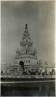 McCarthy Album 03, Photograph 042
 No Caption: Tower of Jewels, Panama-Pacific International Exposition, 1915.
-
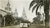 McCarthy Album 03, Photograph 041
 No Caption: Fageol auto train at the Panama-Pacific International Exposition, 1915.
-
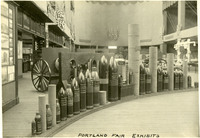 McCarthy Album 03, Photograph 040
 Caption: "Portland Fair Exhibits," Portland, Oregon, 1905. The Lewis and Clark Exposition was held in Portland, Oregon, from June 1st to October 15th, 1905. It celebrated the one-hundred year anniversary of the exploratory expedition of the Louisiana Purchase and what became the northwestern part of the United States, led by Meriwether Lewis and William Clark. Some 1.6 million people visited the fair, viewing exhibits from twenty-one countries.
-
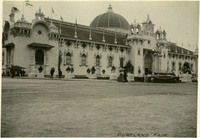 McCarthy Album 03, Photograph 039
 Caption: "Portland Fair," Portland, Oregon, 1905. The Lewis and Clark Exposition was held in Portland, Oregon, from June 1st to October 15th, 1905. It celebrated the one-hundred year anniversary of the exploratory expedition of the Louisiana Purchase and what became the northwestern part of the United States, led by Meriwether Lewis and William Clark. Some 1.6 million people visited the fair, viewing exhibits from twenty-one countries.
-
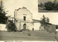 McCarthy Album 03, Photograph 038
 Caption: "San Diego Mission," with small photograph inset of unidentified landscape, c. 1905. See also 96-07-08-alb08-228 with caption: "Old Mission, San Diego." William McCarthy standing before the dilapidated church building of Mission Basilica San Diego de Alcalá (Mission San Diego). The first mission established in California, Mission San Diego was founded by Father Junipero Serra in 1769.
-
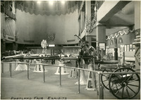 McCarthy Album 03, Photograph 037
 Caption: "Portland Fair Exhibits," Portland, Oregon, 1905. The Lewis and Clark Exposition was held in Portland, Oregon, from June 1st to October 15th, 1905. It celebrated the one-hundred year anniversary of the exploratory expedition of the Louisiana Purchase and what became the northwestern part of the United States, led by Meriwether Lewis and William Clark. Some 1.6 million people visited the fair, viewing exhibits from twenty-one countries.
-
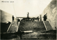 McCarthy Album 03, Photograph 036
 Caption: "Modern Gun," at unidentified location, c. 1905.
-
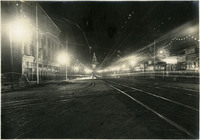 McCarthy Album 03, Photograph 035
 No Caption: San Francisco Market Street scene at night with electric lights, c. 1915.
-
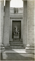 McCarthy Album 03, Photograph 034
 No Caption: Fountain of Spring (Furio Piccirilli, sculptor), in the Court of the Four Seasons at the Panama-Pacific International Exposition, 1915.
-
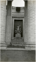 McCarthy Album 03, Photograph 033
 No Caption: Fountain of Winter (Furio Piccirilli, sculptor), in the Court of the Four Seasons at the Panama-Pacific International Exposition, 1915.
-
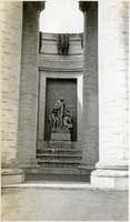 McCarthy Album 03, Photograph 032
 No Caption: Fountain of Summer (Furio Piccirilli, sculptor), in the Court of the Four Seasons at the Panama-Pacific International Exposition, 1915.
-
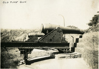 McCarthy Album 03, Photograph 031
 Caption: "Old Time Gun." at unidentified location, c. 1905.
-
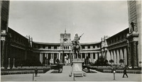 McCarthy Album 03, Photograph 030
 No Caption: The Pioneer (Solon Borglum, sculptor), at the Panama-Pacific International Exposition, 1915.
-
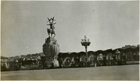 McCarthy Album 03, Photograph 029
 No Caption: Fountain of Energy (A. Stirling Calder, sculptor), at the Panama-Pacific International Exposition, 1915.
-
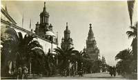 McCarthy Album 03, Photograph 028
 No Caption: Avenue of Palms at the Panama-Pacific International Exposition, 1915.
-
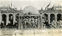 McCarthy Album 03, Photograph 027
 No Caption: Fountain of Earth (Robert I. Aitken, sculptor), at the Panama-Pacific International Exposition, 1915.
-
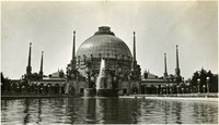 McCarthy Album 03, Photograph 026
 No Caption: Palace of Horticulture at the Panama-Pacific International Exposition, 1915.
-
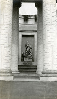 McCarthy Album 03, Photograph 025
 No Caption: Fountain of Autumn (Furio Piccirilli, sculptor), in the Court of the Four Seasons at the Panama-Pacific International Exposition, 1915.
-
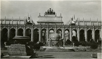 McCarthy Album 03, Photograph 024
 No Caption: Court of Abundance at the Panama-Pacific International Exposition, 1915.
-
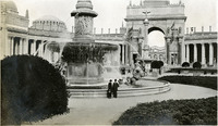 McCarthy Album 03, Photograph 023
 No Caption: Grace and William McCarthy standing alongside fountain at the Panama-Pacific International Exposition, 1915.
-
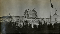 McCarthy Album 03, Photograph 022
 No Caption: The California Building at the Panama-Pacific International Exposition, 1915.
-
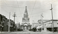 McCarthy Album 03, Photograph 021
 No Caption: Tower of Jewels, Panama-Pacific International Exposition, 1915.
-
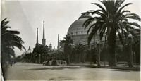 McCarthy Album 03, Photograph 020
 No Caption: The Palace of Horticulture on the right, with Fageol auto train in the foreground, at the Panama-Pacific International Exposition, 1915
-
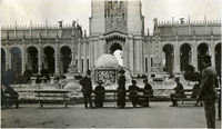 McCarthy Album 03, Photograph 019
 No Caption: William and Grace McCarthy (standing and looking at the camera) at the Panama-Pacific International Exposition, 1915. The Panama Pacific International Exposition was held to celebrate the completion of the Panama Canal, as well as inventive technologies and new industries from around the world. It was also a chance for San Francisco to show the world how the great city had rebuilt and thrived after the devastation of the 1906 earthquake and fire.
-
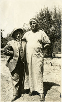 McCarthy Album 03, Photograph 018
 No Caption: See also 96-07-08-alb07-286 with caption: "Harold and Lena, Healdsburg, Aug. 15, 1915."
-
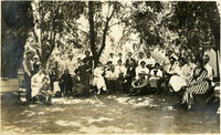 McCarthy Album 03, Photograph 017
 No Caption: See also 96-07-08-alb07-280 with caption: "Riverside Villa Aug. 15, 1915." A group of McCarthy friends and family at Riverside Villa along the Russian River in Healdsburg, Sonoma County, California, 1915.
 McCarthy Album 03, Photograph 066 Caption: "S.P. Shasta Route." Southern Pacific train on the Shasta route with Mt. Shasta in the background, c. 1905.
 McCarthy Album 03, Photograph 065 Caption: "Fort Casey Light House, Wash." c. 1905. Located on Whidbey Island in Puget Sound, the Admiralty Head Lighthouse was built overlooking Admiralty Inlet in 1903. It replaced an earlier structure that had to be moved in 1890 to accommodate the construction of Fort Casey. The second lighthouse, shown here, was built with thick walls in order to withstand earthquakes and the concussion of guns at Fort Casey. The man shown in the photograph is likely Charles H. Davis, who was appointed keeper of the lighthouse in 1900 and served until his death in 1914. The lighthouse, deactivated in 1922, has since been restored by Washington State Parks, and is part of the Fort Casey State Park.
 McCarthy Album 03, Photograph 064 Caption: "Totem Pole, Seattle." Seattle, Washington, c. 1905. View of the Tlingit totem pole in Seattle's Pioneer Square. The totem pole was stolen in 1899 by a group of businessmen, and erected in the square, then known as Pioneer Place. An arsonist destroyed this pole in 1938, but it was later replaced by another carved by the Tlingit tribe (who were also finally paid for the original pole).
 McCarthy Album 03, Photograph 063 Caption: "Fort Worden, Wash." Washington, c. 1908.Construction of Fort Worden in Port Townsend, Washington, on Admiralty Inlet of Puget Sound began in 1898, and by 1902 it was serving as an active U.S. Army base. Fort Worden was part of the "triangle of fire", three coastal defense fortifications (Fort Casey, Fort Worden, and Fort Flagler) guarding the entrance to Puget Sound. The U.S. sold the property to the state of Washington in 1957. In 1973, the fort and surrounding area opened as Fort Worden State Park.
 McCarthy Album 03, Photograph 062 Caption: "Fort Casey Lake," Washington, c. 1908. Peaceful scene at Crockett Lake near Fort Casey, the water so still that the trees and surrounding hills are clearly reflected in the lake's waters.
 McCarthy Album 03, Photograph 061 Caption: "Fort Worden. Mid Winter." Construction of Fort Worden in Port Townsend, Washington, on Admiralty Inlet of Puget Sound began in 1898, and by 1902 it was serving as an active U.S. Army base. Fort Worden was part of the "triangle of fire", three coastal defense fortifications (Fort Casey, Fort Worden, and Fort Flagler) guarding the entrance to Puget Sound. The U.S. sold the property to the state of Washington in 1957. In 1973, the fort and surrounding area opened as Fort Worden State Park.
 McCarthy Album 03, Photograph 060 Caption: "Port Townsend Beach," Washington, c. 1909.
 McCarthy Album 03, Photograph 059 Caption: " Block House, Fort Casey. Used in Early Days as Protection Against the Indians." Washington, c. 1909. View of a blockhouse, a timber structure built by European settlers to guard against attack during the Indian Wars of 1855-1857.
 McCarthy Album 03, Photograph 058 Caption: "Frozen Trees. Pt Townsend," Washington, c. 1909.
 McCarthy Album 03, Photograph 057 Caption: "Fort Flagler Beach," Washington, c. 1909.
 McCarthy Album 03, Photograph 056 Caption: "A.Y.P.E. Seattle." Cascading fountains at the Alaska-Yukon-Pacific Exposition. The Alaska-Yukon-Pacific Exposition was held in Seattle, Washington in 1909 to celebrate the development of the Pacific Northwest. The fair attracted 3.7 million visitors over the course of its run from June to October 1909. Although most of the fair's buildings have since been destroyed, several of them now serve as part of the University of Washington campus.
 McCarthy Album 03, Photograph 055 Caption: "A.Y.P.E. Seattle." Exposition building at the Alaska-Yukon-Pacific Exposition. The Alaska-Yukon-Pacific Exposition was held in Seattle, Washington in 1909 to celebrate the development of the Pacific Northwest. The fair attracted 3.7 million visitors over the course of its run from June to October 1909. Although most of the fair's buildings have since been destroyed, several of them now serve as part of the University of Washington campus.
 McCarthy Album 03, Photograph 054 Caption: "Dry Dock, Bremerton." Bremerton, Washington, c. 1908-1912. See also 96-07-08-alb08-085. View of a dry dock at the Puget Sound Naval Shipyard in Bremerton, Washington. Established in 1891 as a naval station, it became Naval Yard Puget Sound in 1901. During World War I the shipyard constructed hundreds of ships to support the war effort, while in World War II, the shipyard was dedicated primarily to repairing damaged ships. Today, it contains a portion of the U.S. Navy's mothball fleet (ships retired but retained in case of future need), as well as building, repairing, and maintaining sea-going vessels of all kinds.
 McCarthy Album 03, Photograph 053 Caption: "A.Y.P.E. Entrance." See also 96-07-08-alb08-121. The Alaska-Yukon-Pacific Exposition was held in Seattle, Washington in 1909 to celebrate the development of the Pacific Northwest. The fair attracted 3.7 million visitors over the course of its run from June to October 1909. Although most of the fair's buildings have since been destroyed, several of them now serve as part of the University of Washington campus.
 McCarthy Album 03, Photograph 052 Caption: "Pt. Townsend Court House," Washington, c. 1908. See also 96-07-08-alb08-033. View of the Jefferson County Courthouse in Port Townsend, Washington. Built the early 1890s (W.A. Ritchie, architect), the Romanesque-style building features a 124-foot clock tower, red bricks from St. Louis, and sandstone from Alaska.
 McCarthy Album 03, Photograph 051 Caption: "Training Ship. Bremerton," Washington, c. 1908 - 1912. See also 96-07-08-alb08-086. View of the USS Philadelphia (C-4). The fourth ship to bear the name, the Philadelphia first launched in September 1889. She sailed as part of the U.S. Navy's Atlantic Squadron until 1893. She then sailed into the Pacific Ocean, where she served until being decommissioned and docked in Puget Sound in 1902. In 1904, the Navy "housed over" the ship (adding the roofed quarters visible on the upper deck in the photograph) and designated her a receiving ship for new sailors not yet assigned to a crew. The Philadelphia served in this capacity until 1912. After a brief stint as a prison ship, the Philadelphia again became a receiving ship in 1916. The Navy sold her in 1927.
 McCarthy Album 03, Photograph 050 Caption: "Fort Stevens, Oregon," c. 1905. Panorama of Fort Stevens, built in the 1860s as part of the defensive fortifications guarding the mouth of the Columbia River. Located on the Oregon side of the river, the fort was decommissioned after World War II, its armaments and buildings removed and auctioned off. The site now serves as a state park complete with military museum.
 McCarthy Album 03, Photograph 049 Caption: "Washington Street, Portland, Oregon," c. 1905. A street scene with electric car, several storefronts, and pedestrians milling about.
 McCarthy Album 03, Photograph 048 Caption: "Building the Jetty, Columbia River," c. 1905.
 McCarthy Album 03, Photograph 047 Caption: "Driving Piles in the Breakers, Columbia River Jetty." c. 1905.
 McCarthy Album 03, Photograph 046 Caption: " Seaside Beach, Oregon," c. 1905.
 McCarthy Album 03, Photograph 045 Caption: "N.P. Ferry. Columbia River." See also 96-07-08-alb08-114 with caption: "Ferry Boat Tacoma on the Columbia River," Pacific Northwest, c. 1905. View of the railroad ferry Tacoma, with a train on board. The Tacoma operated from 1884 until 1908, when a railroad bridge was constructed across the Columbia connecting Portland, Oregon with points north of the river.
 McCarthy Album 03, Photograph 044 Caption: "Fort Columbia, Wash." Washington, c. 1909.
 McCarthy Album 03, Photograph 043 Caption: "Lewis & Clark Fair, Portland," The Lewis and Clark Exposition was held in Portland, Oregon, from June 1st to October 15th, 1905. It celebrated the one-hundred year anniversary of the exploratory expedition of the Louisiana Purchase and what became the northwestern part of the United States, led by Meriwether Lewis and William Clark. Some 1.6 million people visited the fair, viewing exhibits from twenty-one countries.
 McCarthy Album 03, Photograph 042 No Caption: Tower of Jewels, Panama-Pacific International Exposition, 1915.
 McCarthy Album 03, Photograph 041 No Caption: Fageol auto train at the Panama-Pacific International Exposition, 1915.
 McCarthy Album 03, Photograph 040 Caption: "Portland Fair Exhibits," Portland, Oregon, 1905. The Lewis and Clark Exposition was held in Portland, Oregon, from June 1st to October 15th, 1905. It celebrated the one-hundred year anniversary of the exploratory expedition of the Louisiana Purchase and what became the northwestern part of the United States, led by Meriwether Lewis and William Clark. Some 1.6 million people visited the fair, viewing exhibits from twenty-one countries.
 McCarthy Album 03, Photograph 039 Caption: "Portland Fair," Portland, Oregon, 1905. The Lewis and Clark Exposition was held in Portland, Oregon, from June 1st to October 15th, 1905. It celebrated the one-hundred year anniversary of the exploratory expedition of the Louisiana Purchase and what became the northwestern part of the United States, led by Meriwether Lewis and William Clark. Some 1.6 million people visited the fair, viewing exhibits from twenty-one countries.
 McCarthy Album 03, Photograph 038 Caption: "San Diego Mission," with small photograph inset of unidentified landscape, c. 1905. See also 96-07-08-alb08-228 with caption: "Old Mission, San Diego." William McCarthy standing before the dilapidated church building of Mission Basilica San Diego de Alcalá (Mission San Diego). The first mission established in California, Mission San Diego was founded by Father Junipero Serra in 1769.
 McCarthy Album 03, Photograph 037 Caption: "Portland Fair Exhibits," Portland, Oregon, 1905. The Lewis and Clark Exposition was held in Portland, Oregon, from June 1st to October 15th, 1905. It celebrated the one-hundred year anniversary of the exploratory expedition of the Louisiana Purchase and what became the northwestern part of the United States, led by Meriwether Lewis and William Clark. Some 1.6 million people visited the fair, viewing exhibits from twenty-one countries.
 McCarthy Album 03, Photograph 036 Caption: "Modern Gun," at unidentified location, c. 1905.
 McCarthy Album 03, Photograph 035 No Caption: San Francisco Market Street scene at night with electric lights, c. 1915.
 McCarthy Album 03, Photograph 034 No Caption: Fountain of Spring (Furio Piccirilli, sculptor), in the Court of the Four Seasons at the Panama-Pacific International Exposition, 1915.
 McCarthy Album 03, Photograph 033 No Caption: Fountain of Winter (Furio Piccirilli, sculptor), in the Court of the Four Seasons at the Panama-Pacific International Exposition, 1915.
 McCarthy Album 03, Photograph 032 No Caption: Fountain of Summer (Furio Piccirilli, sculptor), in the Court of the Four Seasons at the Panama-Pacific International Exposition, 1915.
 McCarthy Album 03, Photograph 031 Caption: "Old Time Gun." at unidentified location, c. 1905.
 McCarthy Album 03, Photograph 030 No Caption: The Pioneer (Solon Borglum, sculptor), at the Panama-Pacific International Exposition, 1915.
 McCarthy Album 03, Photograph 029 No Caption: Fountain of Energy (A. Stirling Calder, sculptor), at the Panama-Pacific International Exposition, 1915.
 McCarthy Album 03, Photograph 028 No Caption: Avenue of Palms at the Panama-Pacific International Exposition, 1915.
 McCarthy Album 03, Photograph 027 No Caption: Fountain of Earth (Robert I. Aitken, sculptor), at the Panama-Pacific International Exposition, 1915.
 McCarthy Album 03, Photograph 026 No Caption: Palace of Horticulture at the Panama-Pacific International Exposition, 1915.
 McCarthy Album 03, Photograph 025 No Caption: Fountain of Autumn (Furio Piccirilli, sculptor), in the Court of the Four Seasons at the Panama-Pacific International Exposition, 1915.
 McCarthy Album 03, Photograph 024 No Caption: Court of Abundance at the Panama-Pacific International Exposition, 1915.
 McCarthy Album 03, Photograph 023 No Caption: Grace and William McCarthy standing alongside fountain at the Panama-Pacific International Exposition, 1915.
 McCarthy Album 03, Photograph 022 No Caption: The California Building at the Panama-Pacific International Exposition, 1915.
 McCarthy Album 03, Photograph 021 No Caption: Tower of Jewels, Panama-Pacific International Exposition, 1915.
 McCarthy Album 03, Photograph 020 No Caption: The Palace of Horticulture on the right, with Fageol auto train in the foreground, at the Panama-Pacific International Exposition, 1915
 McCarthy Album 03, Photograph 019 No Caption: William and Grace McCarthy (standing and looking at the camera) at the Panama-Pacific International Exposition, 1915. The Panama Pacific International Exposition was held to celebrate the completion of the Panama Canal, as well as inventive technologies and new industries from around the world. It was also a chance for San Francisco to show the world how the great city had rebuilt and thrived after the devastation of the 1906 earthquake and fire.
 McCarthy Album 03, Photograph 018 No Caption: See also 96-07-08-alb07-286 with caption: "Harold and Lena, Healdsburg, Aug. 15, 1915."
 McCarthy Album 03, Photograph 017 No Caption: See also 96-07-08-alb07-280 with caption: "Riverside Villa Aug. 15, 1915." A group of McCarthy friends and family at Riverside Villa along the Russian River in Healdsburg, Sonoma County, California, 1915.