-
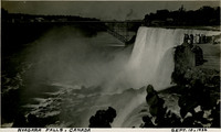 McCarthy Album 11, Photograph 250
 Caption: "Niagara Falls, Canada, Sept. 10, 1934." View of a portion of the iconic Niagara Falls straddling the border between Ontario, Canada, and the State of New York.
-
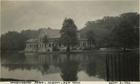 McCarthy Album 11, Photograph 249
 Caption: "Washington Park, Albany, New York, Sept. 8, 1934." Albany's Washington Park was established in the early 1870s. Washington Park Lake, a portion of which is seen in this photograph, was created by damming Beaverkill Creek in 1873. The Lake House in the photograph was constructed in 1929, replacing an earlier building.
-
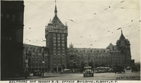 McCarthy Album 11, Photograph 248
 Caption: "Delaware and Hudson R.R. Office Building, Albany, N.Y., Sept. 7, 1934." View of the enormous Gothic building constructed by and for the Delaware and Hudson Railroad Company between 1914-1918. It also housed the offices of the Albany Evening Journal. A small city park sits in front of the building's central tower, surrounded on all sides by a looped street originally intended for trolley cars. The building was gradually abandoned by the businesses within, until purchased in 1973 by the State University of New York (SUNY). SUNY renovated the building for use as its administrative offices, a purpose which it still serves today.
-
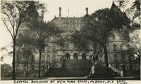 McCarthy Album 11, Photograph 247
 Caption: "Capitol Building of New York State, Albany, N.Y., Sept. 7, 1934." New York State's Capitol Building was constructed between 1867 and 1899. The initial architect, Thomas Fuller, designed the first floor in a Classical or Romanesque style. He was replaced by Leopold Eidlitz and Henry Hobson Richardson, who designed the next two floors in a Renaissance style. The final architect to preside over the project was Isaac G. Perry, who completed the building in a Victorian-Romanesque style. The building was listed on the National Register of Historic Places in 1971, and declared a National Historic Landmark in 1979.
-
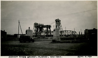 McCarthy Album 11, Photograph 246
 Caption: "Hudson River Bridge, Albany, New York. Sept. 7, 1934." View of an automobile bridge in the foreground, with a concrete deck, and what appears to be a railroad bridge, possibly of the bascule or swing type, in the background.
-
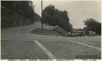 McCarthy Album 11, Photograph 245
 Caption: "Mohawk Trail, Hoosac Mountains, Massachusetts. Greenfield Mass to Albany New York, Sept 7, 1934." Hairpin turn on the Mohawk Trail, a scenic highway in Massachusetts. The Trail, originally a trade route for Native American tribes, was adopted as the route for the first scenic road constructed in the state. A gravel road was built along the route between 1912 and 1914, and later expanded as automobile traffic increased nation-wide. It is now part of Massachusetts Route 2.
-
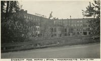 McCarthy Album 11, Photograph 244
 Caption: "Starrett Tool Works, Athol, Massachusetts. Sept. 6, 1934." The Starrett Tool Works was founded in 1880, when Laroy Sunderland Starrett started a tool shop in Athol. He later expanded the facility, until by 1906 the company employed more than 1,000 workers in the manufacture of precision tools. By the time Starrett died in 1922, the company had achieved global recognition, establishing offices in more than a dozen countries. Starrett is still in operation today.
-
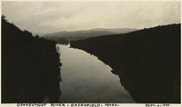 McCarthy Album 11, Photograph 243
 Caption: "Connecticut River, Greenfield. Mass. Sept. 6, 1934." Picturesque view of the Connecticut River, flanked by rolling hills and mirroring the clouds in the sky above.
-
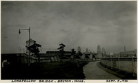 McCarthy Album 11, Photograph 242
 Caption: "Longfellow Bridge, Boston, Mass. Sept. 5, 1934." The Longfellow Bridge spans the Charles River between Boston and Cambridge. Originally called the Cambridge Bridge, it replaced a wood structure called the West Boston Bridge that had been constructed in 1793. This wood bridge was unable to handle large volumes of traffic or the introduction of street cars, so a new bridge was built in the early twentieth century. Opened in 1906 as the Cambridge Bridge, the name was changed in 1927 to the Longfellow Bridge in honor of poet Henry Wadsworth Longfellow. It is colloquially known as the Salt and Pepper Bridge, as its central towers are reminiscent in shape of salt and pepper shakers.
-
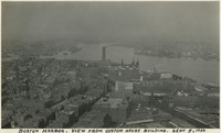 McCarthy Album 11, Photograph 241
 Caption: "Boston Harbor. View from Custom House Building. Sept 5, 1934." Bird's eye view of Boston Harbor and surrounding port and wharf facilities.
-
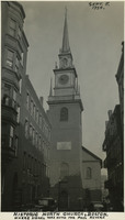 McCarthy Album 11, Photograph 240
 Caption: "Historic North Church, Boston. Where Signal was Hung for Paul Revere, Sept. 5, 1934." View of the clock tower and steeple of the Old North Church, built in 1723. The church is said to be the site where Paul Revere, after his famous midnight ride, caused two lanterns to be hung as the signal that British troops were advancing into the area by sea rather than by land.
-
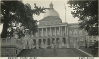 McCarthy Album 11, Photograph 239
 Caption: "Boston State House. Sept. 5, 1934." The Massachusetts State House has been the seat of government for the Commonwealth of Massachusetts since its completion in 1798. Designed by Charles Bullfinch, its prominent feature is its gold-leafed dome. The building, a significant example of Federal architecture in a civic structure, has been declared a National Historic Landmark.
-
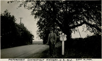 McCarthy Album 11, Photograph 238
 Caption: "Picturesque Connecticut Highway. U.S. No 1. Sept. 4, 1934." William McCarthy standing next to a U.S. Route 1 sign along a tree-lined highway. U.S. Route 1 is a north-south highway connecting the eastern seaboard from Fort Kent, Maine to Key West, Florida.
-
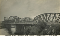 McCarthy Album 11, Photograph 237
 Caption: "Thames River Bridge, New London, Connecticut. Where Harvard and Yale Hold their Annual Rowing Regatta, Sept. 4, 1934." View of two bridges over the Thames River near New London, Connecticut. The drawbridge in the foreground was originally a railroad bridge, built in the late nineteenth century. Later, as automobiles grew in popularity, this bridge was converted to use by vehicles (cars can be seen driving over it in this photograph), and a second bridge was constructed for railroad use (a locomotive can be seen behind the two cars). Neither of these bridges survives today, having been replaced by the Gold Star Memorial Bridge.
-
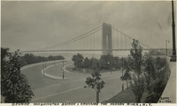 McCarthy Album 11, Photograph 236
 Caption: "George Washington Bridge, Crossing the Hudson River, N.Y. Sept. 3, 1934." This suspension bridge, designed by Othmar Ammann, spans the Hudson River between Manhattan in New York City, and Fort Lee, New Jersey. Constructed between 1927 and 1931, the bridge included the longest main span in the world at the time, a record it held until construction of the Golden Gate Bridge was completed in 1937. It was originally built with only one deck (as seen in this photograph), but a second deck opened in 1962. Still in active use today, it carried over 51 million vehicles in 2016.
-
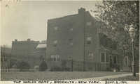 McCarthy Album 11, Photograph 235
 Caption: "The Walsh Home, Brooklyn, New York. Sept. 2, 1934." View of a three-story brick house or apartment building, with a park or empty lot on one side. See also 96-07-08-alb09-202.
-
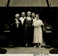 McCarthy Album 11, Photograph 234
 Caption: "Sept. 1, 1934." Grace McCarthy (center) posing with Jim Walsh (second from the right), his wife (far right), and two unidentified individuals, in front of a covered patio.
-
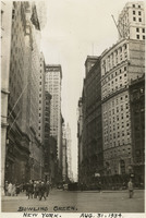 McCarthy Album 11, Photograph 233
 Caption: "Bowling Green, New York. Aug. 31, 1934." Street scene in New York City, showing Broadway near the small public park Bowling Green. See also 96-07-08-alb04-076 and 96-07-08-alb09-204.
-
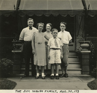 McCarthy Album 11, Photograph 232
 Caption: "The Jim Walsh Family. Aug. 30, 193 [sic]." Jim Walsh (at left), his wife, and three children posing for a photograph in front of a covered patio.
-
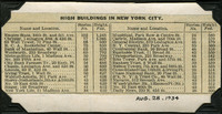 McCarthy Album 11, Photograph 231a
 Caption: "Aug. 28, 1934." Clipping from unidentified newspaper or pamphlet regarding "High Buildings in New York City." The clipping gives the names, addresses, number of stories, and height in feet of thirty-four New York skyscrapers.
-
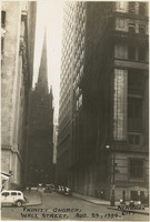 McCarthy Album 11, Photograph 231
 Caption: "Trinity Church, Wall Street. Aug. 29, 1934. New York City." The 281-foot-high steeple of Trinity Church spears the sky between two tall buildings on New York City's Wall Street in this photograph. The church, dedicated in 1846, was the third church built at the site. Designed by Richard Upjohn when the second Trinity Church had to be replaced due to structural issues, the present church is one of the earliest examples of Gothic Revival or Neo-Gothic architecture in the nation. It was declared a National Historic Landmark in 1976.
-
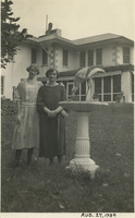 McCarthy Album 11, Photograph 230
 Caption: "Aug. 27, 1934." Grace McCarthy and an unidentified woman posing beside large bird bath or fountain, in front of the John Shields residence in the Daybreak Estate area of Long Island. See also 96-07-08-alb04-071 and 96-07-08-alb09-208.
-
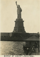 McCarthy Album 11, Photograph 229
 Caption: "Statue of Liberty, New York." View of the Statue of Liberty on Bedloe Island (now called Liberty Island). Designed by French sculptor Frédéric Auguste Bartholdi, the now-iconic statue was a gift from the people of France to the U.S. Built in segments in France by Gustave Eiffel (also famous for building the Eiffel Tower in Paris), the pieces were shipped from Paris to New York in 1885 and assembled. The Statue of Liberty was subsequently dedicated on October 28, 1886.
-
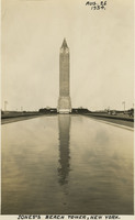 McCarthy Album 11, Photograph 228
 Caption: "Jones's [sic] Beach Tower, New York. Aug. 26 1934." The large tower in the center of this photograph was a 188-foot-tall water tower in Jones Beach, built in 1930 in imitation of the Italianate-style bell tower of St. Mark's Basilica in Venice, Italy. The Long Island State Park Commission began to develop what is now the Jones Beach area for a park in the 1920s, dredging enough sand to connect several of the barrier islands south of Long Island and raising the elevation of the islands by fourteen feet to create one large park. It opened to the public in 1929. It is now a state park, with an estimated six million visitors each year.
-
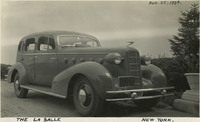 McCarthy Album 11, Photograph 227
 Caption: "The La Salle [sic], New York. Aug. 25, 1934." View of a Cadillac LaSalle parked in a driveway. The LaSalle was produced by General Motors' Cadillac division between 1927 and 1940.
-
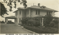 McCarthy Album 11, Photograph 226
 Caption: "Daybreak. Side View, Long Island, New York. Aug. 24, 1934." Residence of John Shields, on Long Island in the Daybreak Estate area.
-
 McCarthy Album 11, Photograph 225
 Caption: "Vincent, Aug. 23, 1934." Young boy posing for a photograph on a patio or in a garden.
-
 McCarthy Album 11, Photograph 224
 Caption: "Aug. 22, 1934." Unidentified man and woman posing in a garden.
-
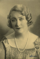 McCarthy Album 11, Photograph 223
 No caption, c. 1934. Undated photograph of an unidentified woman, possibly taken in a photography studio.
-
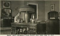 McCarthy Album 11, Photograph 222
 Caption: "Guest Room, Daybreak, Long Island, New York. Aug. 21, 1934." Grace McCarthy seated at a desk reading a book, with a bed to one side and a dresser on the other. See also 96-07-08-alb09-174.
-
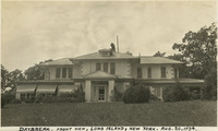 McCarthy Album 11, Photograph 221
 Caption: "Daybreak. Front View, Long Island, New York. Aug. 20, 1934." Residence of John Shields, on Long Island in the Daybreak Estate area. See also 96-07-08-alb09-159.
-
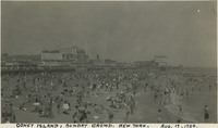 McCarthy Album 11, Photograph 220
 Caption: "Coney Island, Sunday Crowd. New York. Aug. 19, 1934." Very crowded beach scene on New York's Coney Island. The construction of several resort hotels on the island in the 1870s and 1880s encouraged construction of amusement parks to provide tourist destinations. Coney Island has hosted several large amusement parks over the years, including one of the world's first roller coasters (built in 1884). Numerous smaller attractions were available as well. The island's popularity peaked in the World War II era, but despite some decline is still a world-renowned recreation area.
-
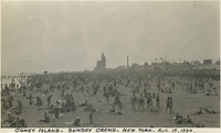 McCarthy Album 11, Photograph 219
 Caption: "Coney Island. Sunday Crowd. New York. Aug. 19, 1934." Very crowded beach scene on New York's Coney Island. The construction of several resort hotels on the island in the 1870s and 1880s encouraged construction of amusement parks to provide tourist destinations. Coney Island has hosted several large amusement parks over the years, including one of the world's first roller coasters (built in 1884). Numerous smaller attractions were available as well. The island's popularity peaked in the mid-twentieth century, in the World War II era, but despite some decline is still a world-renowned recreation area.
-
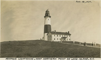 McCarthy Album 11, Photograph 218
 Caption: "Montauk Lighthouse, Most Northern Point on Long Island, N.Y., Aug. 18, 1934." The Montauk Lighthouse, first lit in 1797, was the first lighthouse built in New York. Ezra L'Hommedieu designed the building as well as choosing its site on the eastern edge of Long Island. A renovation in 1860 raised the lighthouse to its current height of more than 110 feet. A larger lantern was installed at that time as well. Electrified in 1940, it is now a National Historic Landmark as well as an active lighthouse.
-
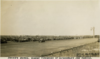 McCarthy Album 11, Photograph 217
 Caption: "Jones's [sic] Beach. Where Thousands of Automobiles are Parked. Long Island, N.Y. Aug. 17, 1934." Photograph of a large parking area full of automobiles on Jones Beach Island. The Long Island State Park Commission began to develop the area for a park in the 1920s, dredging enough sand to connect several of the barrier islands south of Long Island and raising the elevation of the islands by fourteen feet to create one large park. It opened to the public in 1929. It is now a state park, with an estimated six million visitors each year.
-
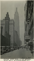 McCarthy Album 11, Photograph 216
 Caption: "Empire State Bldg. in the Distance. Height 1250 Feet, 102 Stories. 34th St. New York. Aug. 16, 1934." Street scene dominated by the Empire State Building rising a few blocks away. Construction began on this iconic 102-story building, designed by William F. Lamb, in 1930. Completed by early 1931, it held the title of world's tallest building for almost 40 years, until being surpassed in 1970 by the construction of the World Trade Center's North Tower. It is now the fifth-tallest building in the U.S., and the 28th-tallest in the world.
-
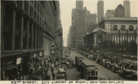 McCarthy Album 11, Photograph 215
 Caption: "42nd Street. City Library on right, New York City, N.Y. Aug. 15, 1934." Busy street scene along New York City's 42nd Street, showing numerous pedestrians, automobiles, and street trolleys. On the right side of the photograph can be seen the side of the New York Public Library's main building, opened in 1911. At the time of its opening, the Library's main reading room was the largest of its kind in the world.
-
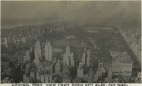 McCarthy Album 11, Photograph 214
 Caption: "Central Park. View from Radio City Blg. New York. Aug. 14, 1934." Bird's eye view of New York City's 843-acre Central Park. Landscape architect Frederick Law Olmstead and architect Calvert Vaux designed the park, the first portion of which opened to the public in 1858. It was designated a National Historic Landmark in 1962.
-
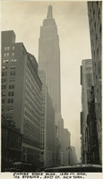 McCarthy Album 11, Photograph 213
 Caption: "Empire State Bldg. 1250 Ft. High, 102 Stories. 34th St. New York. Aug. 13, 1934." View from the sidewalk, looking up at the Empire State Building. Construction began on this iconic 102-story building, designed by William F. Lamb, in 1930. Completed by early 1931, it held the title of world's tallest building for almost 40 years, until being surpassed in 1970 by the construction of the World Trade Center's North Tower. It is now the fifth-tallest building in the U.S., and the 28th-tallest in the world.
-
 McCarthy Album 11, Photograph 212
 Caption: "The Ghetto with its Street Venders [sic], New York City. Aug. 12, 1934." Crowded street scene in New York City, with numerous street vendors selling a variety of goods, including vegetables and toiletry supplies.
-
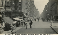 McCarthy Album 11, Photograph 211
 Caption: "The Ghetto. Where People Almost Live on the Street, New York City, Aug. 12, 1934." Crowded street scene in New York City, with numerous open-air stalls and storefronts hawking wares.
-
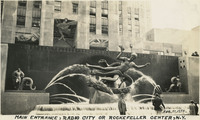 McCarthy Album 11, Photograph 210
 Caption: "Main Entrance, Radio City or Rockefeller Center, N.Y. Aug 11, 1934." William McCarthy standing in front of the Prometheus sculpture in Rockefeller Center. The gilded bronze statue, designed by sculptor Paul Manship, was erected in 1934 in the middle of New York's Rockefeller Center.
-
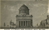 McCarthy Album 11, Photograph 209
 Caption: "General U.S. Grants [sic] Tomb, Riverside Drive. New York, Aug. 10, 1934." The remains of Ulysses S. Grant, 18th President of the U.S. and Commanding General of the Union Army during the last year of the Civil War, were laid to rest in this elaborate tomb. Grant died in 1885, but construction on the tomb did not begin until 1891. Grant's remains were transferred to the tomb on April 27, 1897.
-
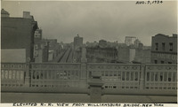 McCarthy Album 11, Photograph 208
 Caption: "Elevated R.R. View from Williamsburg Bridge. New York, Aug. 9, 1934." Bird's eye view of a portion of New York City, from the Williamsburg Bridge over the East River. An elevated railway dominates the center of the photograph.
-
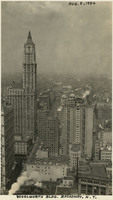 McCarthy Album 11, Photograph 207
 Caption: "Woolworth Bldg. Broadway, N.Y. Aug. 8, 1934." Bird's eye view of a portion of New York City, with the Woolworth Building at the left. Constructed between 1910 and 1920 and designed by architect Cass Gilbert, the Neo-Gothic building was once the tallest in the world at 792 feet.
-
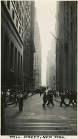 McCarthy Album 11, Photograph 206
 Caption: "Wall Street, New York. Aug 8 1934." Street scene on Wall Street, New York City. Bustling crowds fill the sidewalks while tall buildings loom on each side of the street.
-
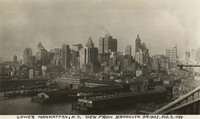 McCarthy Album 11, Photograph 205
 Caption: "Lower Manhattan, N.Y. View from Brooklyn Bridge. Aug. 7, 1934." View of Manhattan's skyline and wharf facilities.
-
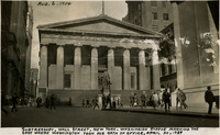 McCarthy Album 11, Photograph 204
 Caption: "Subtreasury, Wall Street, New York. Washingion [sic] Statue Marking the Spot Where Washington took his Oath of Office, April 30, 1789, Aug. 6, 1934." The original building on this site, constructed in 1700, served as New York's City Hall, then as the Capitol for the newly-created United States under the Constitution of 1789, and was the site of George Washington's inauguration as the first U.S. President. The original building was demolished in 1812, but a new building, designed to house the U.S. Custom House for the Port of New York, was opened in 1842. It is this building that is seen in the photograph. The new building subsequently housed one of six U.S. sub-treasuries between 1862 and 1920. A statue of George Washington (John Quincy Adams Ward, sculptor) was erected in front of the building in 1882, to commemorate the approximate site of Washington's inauguration.
-
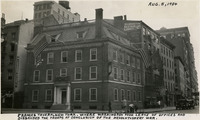 McCarthy Album 11, Photograph 203
 Caption: "Frances [sic] Tavern, New York. Where Washington Took Leave of Offices and Disbanded the Troops at Conclusion of the Revolutionary [sic] War. Aug. 5, 1934." Built as a family home for Etienne "Stephen" DeLancey in 1719, this building was converted to use as a tavern in 1762. It served many important functions before, during, and after the Revolutionary War, but several fires in the nineteenth century erased the building's original appearance. The Sons of the Revolution purchased the property in 1904 and embarked upon extensive restoration plans in 1907, supervised by William Mersereau. The building is now used as a museum and art gallery.
-
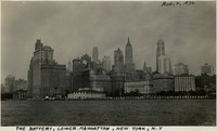 McCarthy Album 11, Photograph 202
 Caption: "The Battery, Lower Manhattan, New York, N.Y [sic], Aug. 4, 1934." This photograph shows the Manhattan skyline, as well as the Battery, a 25-acre park at the tip of Manhattan Island. The park was named for the artillery batteries that used to protect the city and its harbor from this location.
 McCarthy Album 11, Photograph 250 Caption: "Niagara Falls, Canada, Sept. 10, 1934." View of a portion of the iconic Niagara Falls straddling the border between Ontario, Canada, and the State of New York.
 McCarthy Album 11, Photograph 249 Caption: "Washington Park, Albany, New York, Sept. 8, 1934." Albany's Washington Park was established in the early 1870s. Washington Park Lake, a portion of which is seen in this photograph, was created by damming Beaverkill Creek in 1873. The Lake House in the photograph was constructed in 1929, replacing an earlier building.
 McCarthy Album 11, Photograph 248 Caption: "Delaware and Hudson R.R. Office Building, Albany, N.Y., Sept. 7, 1934." View of the enormous Gothic building constructed by and for the Delaware and Hudson Railroad Company between 1914-1918. It also housed the offices of the Albany Evening Journal. A small city park sits in front of the building's central tower, surrounded on all sides by a looped street originally intended for trolley cars. The building was gradually abandoned by the businesses within, until purchased in 1973 by the State University of New York (SUNY). SUNY renovated the building for use as its administrative offices, a purpose which it still serves today.
 McCarthy Album 11, Photograph 247 Caption: "Capitol Building of New York State, Albany, N.Y., Sept. 7, 1934." New York State's Capitol Building was constructed between 1867 and 1899. The initial architect, Thomas Fuller, designed the first floor in a Classical or Romanesque style. He was replaced by Leopold Eidlitz and Henry Hobson Richardson, who designed the next two floors in a Renaissance style. The final architect to preside over the project was Isaac G. Perry, who completed the building in a Victorian-Romanesque style. The building was listed on the National Register of Historic Places in 1971, and declared a National Historic Landmark in 1979.
 McCarthy Album 11, Photograph 246 Caption: "Hudson River Bridge, Albany, New York. Sept. 7, 1934." View of an automobile bridge in the foreground, with a concrete deck, and what appears to be a railroad bridge, possibly of the bascule or swing type, in the background.
 McCarthy Album 11, Photograph 245 Caption: "Mohawk Trail, Hoosac Mountains, Massachusetts. Greenfield Mass to Albany New York, Sept 7, 1934." Hairpin turn on the Mohawk Trail, a scenic highway in Massachusetts. The Trail, originally a trade route for Native American tribes, was adopted as the route for the first scenic road constructed in the state. A gravel road was built along the route between 1912 and 1914, and later expanded as automobile traffic increased nation-wide. It is now part of Massachusetts Route 2.
 McCarthy Album 11, Photograph 244 Caption: "Starrett Tool Works, Athol, Massachusetts. Sept. 6, 1934." The Starrett Tool Works was founded in 1880, when Laroy Sunderland Starrett started a tool shop in Athol. He later expanded the facility, until by 1906 the company employed more than 1,000 workers in the manufacture of precision tools. By the time Starrett died in 1922, the company had achieved global recognition, establishing offices in more than a dozen countries. Starrett is still in operation today.
 McCarthy Album 11, Photograph 243 Caption: "Connecticut River, Greenfield. Mass. Sept. 6, 1934." Picturesque view of the Connecticut River, flanked by rolling hills and mirroring the clouds in the sky above.
 McCarthy Album 11, Photograph 242 Caption: "Longfellow Bridge, Boston, Mass. Sept. 5, 1934." The Longfellow Bridge spans the Charles River between Boston and Cambridge. Originally called the Cambridge Bridge, it replaced a wood structure called the West Boston Bridge that had been constructed in 1793. This wood bridge was unable to handle large volumes of traffic or the introduction of street cars, so a new bridge was built in the early twentieth century. Opened in 1906 as the Cambridge Bridge, the name was changed in 1927 to the Longfellow Bridge in honor of poet Henry Wadsworth Longfellow. It is colloquially known as the Salt and Pepper Bridge, as its central towers are reminiscent in shape of salt and pepper shakers.
 McCarthy Album 11, Photograph 241 Caption: "Boston Harbor. View from Custom House Building. Sept 5, 1934." Bird's eye view of Boston Harbor and surrounding port and wharf facilities.
 McCarthy Album 11, Photograph 240 Caption: "Historic North Church, Boston. Where Signal was Hung for Paul Revere, Sept. 5, 1934." View of the clock tower and steeple of the Old North Church, built in 1723. The church is said to be the site where Paul Revere, after his famous midnight ride, caused two lanterns to be hung as the signal that British troops were advancing into the area by sea rather than by land.
 McCarthy Album 11, Photograph 239 Caption: "Boston State House. Sept. 5, 1934." The Massachusetts State House has been the seat of government for the Commonwealth of Massachusetts since its completion in 1798. Designed by Charles Bullfinch, its prominent feature is its gold-leafed dome. The building, a significant example of Federal architecture in a civic structure, has been declared a National Historic Landmark.
 McCarthy Album 11, Photograph 238 Caption: "Picturesque Connecticut Highway. U.S. No 1. Sept. 4, 1934." William McCarthy standing next to a U.S. Route 1 sign along a tree-lined highway. U.S. Route 1 is a north-south highway connecting the eastern seaboard from Fort Kent, Maine to Key West, Florida.
 McCarthy Album 11, Photograph 237 Caption: "Thames River Bridge, New London, Connecticut. Where Harvard and Yale Hold their Annual Rowing Regatta, Sept. 4, 1934." View of two bridges over the Thames River near New London, Connecticut. The drawbridge in the foreground was originally a railroad bridge, built in the late nineteenth century. Later, as automobiles grew in popularity, this bridge was converted to use by vehicles (cars can be seen driving over it in this photograph), and a second bridge was constructed for railroad use (a locomotive can be seen behind the two cars). Neither of these bridges survives today, having been replaced by the Gold Star Memorial Bridge.
 McCarthy Album 11, Photograph 236 Caption: "George Washington Bridge, Crossing the Hudson River, N.Y. Sept. 3, 1934." This suspension bridge, designed by Othmar Ammann, spans the Hudson River between Manhattan in New York City, and Fort Lee, New Jersey. Constructed between 1927 and 1931, the bridge included the longest main span in the world at the time, a record it held until construction of the Golden Gate Bridge was completed in 1937. It was originally built with only one deck (as seen in this photograph), but a second deck opened in 1962. Still in active use today, it carried over 51 million vehicles in 2016.
 McCarthy Album 11, Photograph 235 Caption: "The Walsh Home, Brooklyn, New York. Sept. 2, 1934." View of a three-story brick house or apartment building, with a park or empty lot on one side. See also 96-07-08-alb09-202.
 McCarthy Album 11, Photograph 234 Caption: "Sept. 1, 1934." Grace McCarthy (center) posing with Jim Walsh (second from the right), his wife (far right), and two unidentified individuals, in front of a covered patio.
 McCarthy Album 11, Photograph 233 Caption: "Bowling Green, New York. Aug. 31, 1934." Street scene in New York City, showing Broadway near the small public park Bowling Green. See also 96-07-08-alb04-076 and 96-07-08-alb09-204.
 McCarthy Album 11, Photograph 232 Caption: "The Jim Walsh Family. Aug. 30, 193 [sic]." Jim Walsh (at left), his wife, and three children posing for a photograph in front of a covered patio.
 McCarthy Album 11, Photograph 231a Caption: "Aug. 28, 1934." Clipping from unidentified newspaper or pamphlet regarding "High Buildings in New York City." The clipping gives the names, addresses, number of stories, and height in feet of thirty-four New York skyscrapers.
 McCarthy Album 11, Photograph 231 Caption: "Trinity Church, Wall Street. Aug. 29, 1934. New York City." The 281-foot-high steeple of Trinity Church spears the sky between two tall buildings on New York City's Wall Street in this photograph. The church, dedicated in 1846, was the third church built at the site. Designed by Richard Upjohn when the second Trinity Church had to be replaced due to structural issues, the present church is one of the earliest examples of Gothic Revival or Neo-Gothic architecture in the nation. It was declared a National Historic Landmark in 1976.
 McCarthy Album 11, Photograph 230 Caption: "Aug. 27, 1934." Grace McCarthy and an unidentified woman posing beside large bird bath or fountain, in front of the John Shields residence in the Daybreak Estate area of Long Island. See also 96-07-08-alb04-071 and 96-07-08-alb09-208.
 McCarthy Album 11, Photograph 229 Caption: "Statue of Liberty, New York." View of the Statue of Liberty on Bedloe Island (now called Liberty Island). Designed by French sculptor Frédéric Auguste Bartholdi, the now-iconic statue was a gift from the people of France to the U.S. Built in segments in France by Gustave Eiffel (also famous for building the Eiffel Tower in Paris), the pieces were shipped from Paris to New York in 1885 and assembled. The Statue of Liberty was subsequently dedicated on October 28, 1886.
 McCarthy Album 11, Photograph 228 Caption: "Jones's [sic] Beach Tower, New York. Aug. 26 1934." The large tower in the center of this photograph was a 188-foot-tall water tower in Jones Beach, built in 1930 in imitation of the Italianate-style bell tower of St. Mark's Basilica in Venice, Italy. The Long Island State Park Commission began to develop what is now the Jones Beach area for a park in the 1920s, dredging enough sand to connect several of the barrier islands south of Long Island and raising the elevation of the islands by fourteen feet to create one large park. It opened to the public in 1929. It is now a state park, with an estimated six million visitors each year.
 McCarthy Album 11, Photograph 227 Caption: "The La Salle [sic], New York. Aug. 25, 1934." View of a Cadillac LaSalle parked in a driveway. The LaSalle was produced by General Motors' Cadillac division between 1927 and 1940.
 McCarthy Album 11, Photograph 226 Caption: "Daybreak. Side View, Long Island, New York. Aug. 24, 1934." Residence of John Shields, on Long Island in the Daybreak Estate area.
 McCarthy Album 11, Photograph 225 Caption: "Vincent, Aug. 23, 1934." Young boy posing for a photograph on a patio or in a garden.
 McCarthy Album 11, Photograph 224 Caption: "Aug. 22, 1934." Unidentified man and woman posing in a garden.
 McCarthy Album 11, Photograph 223 No caption, c. 1934. Undated photograph of an unidentified woman, possibly taken in a photography studio.
 McCarthy Album 11, Photograph 222 Caption: "Guest Room, Daybreak, Long Island, New York. Aug. 21, 1934." Grace McCarthy seated at a desk reading a book, with a bed to one side and a dresser on the other. See also 96-07-08-alb09-174.
 McCarthy Album 11, Photograph 221 Caption: "Daybreak. Front View, Long Island, New York. Aug. 20, 1934." Residence of John Shields, on Long Island in the Daybreak Estate area. See also 96-07-08-alb09-159.
 McCarthy Album 11, Photograph 220 Caption: "Coney Island, Sunday Crowd. New York. Aug. 19, 1934." Very crowded beach scene on New York's Coney Island. The construction of several resort hotels on the island in the 1870s and 1880s encouraged construction of amusement parks to provide tourist destinations. Coney Island has hosted several large amusement parks over the years, including one of the world's first roller coasters (built in 1884). Numerous smaller attractions were available as well. The island's popularity peaked in the World War II era, but despite some decline is still a world-renowned recreation area.
 McCarthy Album 11, Photograph 219 Caption: "Coney Island. Sunday Crowd. New York. Aug. 19, 1934." Very crowded beach scene on New York's Coney Island. The construction of several resort hotels on the island in the 1870s and 1880s encouraged construction of amusement parks to provide tourist destinations. Coney Island has hosted several large amusement parks over the years, including one of the world's first roller coasters (built in 1884). Numerous smaller attractions were available as well. The island's popularity peaked in the mid-twentieth century, in the World War II era, but despite some decline is still a world-renowned recreation area.
 McCarthy Album 11, Photograph 218 Caption: "Montauk Lighthouse, Most Northern Point on Long Island, N.Y., Aug. 18, 1934." The Montauk Lighthouse, first lit in 1797, was the first lighthouse built in New York. Ezra L'Hommedieu designed the building as well as choosing its site on the eastern edge of Long Island. A renovation in 1860 raised the lighthouse to its current height of more than 110 feet. A larger lantern was installed at that time as well. Electrified in 1940, it is now a National Historic Landmark as well as an active lighthouse.
 McCarthy Album 11, Photograph 217 Caption: "Jones's [sic] Beach. Where Thousands of Automobiles are Parked. Long Island, N.Y. Aug. 17, 1934." Photograph of a large parking area full of automobiles on Jones Beach Island. The Long Island State Park Commission began to develop the area for a park in the 1920s, dredging enough sand to connect several of the barrier islands south of Long Island and raising the elevation of the islands by fourteen feet to create one large park. It opened to the public in 1929. It is now a state park, with an estimated six million visitors each year.
 McCarthy Album 11, Photograph 216 Caption: "Empire State Bldg. in the Distance. Height 1250 Feet, 102 Stories. 34th St. New York. Aug. 16, 1934." Street scene dominated by the Empire State Building rising a few blocks away. Construction began on this iconic 102-story building, designed by William F. Lamb, in 1930. Completed by early 1931, it held the title of world's tallest building for almost 40 years, until being surpassed in 1970 by the construction of the World Trade Center's North Tower. It is now the fifth-tallest building in the U.S., and the 28th-tallest in the world.
 McCarthy Album 11, Photograph 215 Caption: "42nd Street. City Library on right, New York City, N.Y. Aug. 15, 1934." Busy street scene along New York City's 42nd Street, showing numerous pedestrians, automobiles, and street trolleys. On the right side of the photograph can be seen the side of the New York Public Library's main building, opened in 1911. At the time of its opening, the Library's main reading room was the largest of its kind in the world.
 McCarthy Album 11, Photograph 214 Caption: "Central Park. View from Radio City Blg. New York. Aug. 14, 1934." Bird's eye view of New York City's 843-acre Central Park. Landscape architect Frederick Law Olmstead and architect Calvert Vaux designed the park, the first portion of which opened to the public in 1858. It was designated a National Historic Landmark in 1962.
 McCarthy Album 11, Photograph 213 Caption: "Empire State Bldg. 1250 Ft. High, 102 Stories. 34th St. New York. Aug. 13, 1934." View from the sidewalk, looking up at the Empire State Building. Construction began on this iconic 102-story building, designed by William F. Lamb, in 1930. Completed by early 1931, it held the title of world's tallest building for almost 40 years, until being surpassed in 1970 by the construction of the World Trade Center's North Tower. It is now the fifth-tallest building in the U.S., and the 28th-tallest in the world.
 McCarthy Album 11, Photograph 212 Caption: "The Ghetto with its Street Venders [sic], New York City. Aug. 12, 1934." Crowded street scene in New York City, with numerous street vendors selling a variety of goods, including vegetables and toiletry supplies.
 McCarthy Album 11, Photograph 211 Caption: "The Ghetto. Where People Almost Live on the Street, New York City, Aug. 12, 1934." Crowded street scene in New York City, with numerous open-air stalls and storefronts hawking wares.
 McCarthy Album 11, Photograph 210 Caption: "Main Entrance, Radio City or Rockefeller Center, N.Y. Aug 11, 1934." William McCarthy standing in front of the Prometheus sculpture in Rockefeller Center. The gilded bronze statue, designed by sculptor Paul Manship, was erected in 1934 in the middle of New York's Rockefeller Center.
 McCarthy Album 11, Photograph 209 Caption: "General U.S. Grants [sic] Tomb, Riverside Drive. New York, Aug. 10, 1934." The remains of Ulysses S. Grant, 18th President of the U.S. and Commanding General of the Union Army during the last year of the Civil War, were laid to rest in this elaborate tomb. Grant died in 1885, but construction on the tomb did not begin until 1891. Grant's remains were transferred to the tomb on April 27, 1897.
 McCarthy Album 11, Photograph 208 Caption: "Elevated R.R. View from Williamsburg Bridge. New York, Aug. 9, 1934." Bird's eye view of a portion of New York City, from the Williamsburg Bridge over the East River. An elevated railway dominates the center of the photograph.
 McCarthy Album 11, Photograph 207 Caption: "Woolworth Bldg. Broadway, N.Y. Aug. 8, 1934." Bird's eye view of a portion of New York City, with the Woolworth Building at the left. Constructed between 1910 and 1920 and designed by architect Cass Gilbert, the Neo-Gothic building was once the tallest in the world at 792 feet.
 McCarthy Album 11, Photograph 206 Caption: "Wall Street, New York. Aug 8 1934." Street scene on Wall Street, New York City. Bustling crowds fill the sidewalks while tall buildings loom on each side of the street.
 McCarthy Album 11, Photograph 205 Caption: "Lower Manhattan, N.Y. View from Brooklyn Bridge. Aug. 7, 1934." View of Manhattan's skyline and wharf facilities.
 McCarthy Album 11, Photograph 204 Caption: "Subtreasury, Wall Street, New York. Washingion [sic] Statue Marking the Spot Where Washington took his Oath of Office, April 30, 1789, Aug. 6, 1934." The original building on this site, constructed in 1700, served as New York's City Hall, then as the Capitol for the newly-created United States under the Constitution of 1789, and was the site of George Washington's inauguration as the first U.S. President. The original building was demolished in 1812, but a new building, designed to house the U.S. Custom House for the Port of New York, was opened in 1842. It is this building that is seen in the photograph. The new building subsequently housed one of six U.S. sub-treasuries between 1862 and 1920. A statue of George Washington (John Quincy Adams Ward, sculptor) was erected in front of the building in 1882, to commemorate the approximate site of Washington's inauguration.
 McCarthy Album 11, Photograph 203 Caption: "Frances [sic] Tavern, New York. Where Washington Took Leave of Offices and Disbanded the Troops at Conclusion of the Revolutionary [sic] War. Aug. 5, 1934." Built as a family home for Etienne "Stephen" DeLancey in 1719, this building was converted to use as a tavern in 1762. It served many important functions before, during, and after the Revolutionary War, but several fires in the nineteenth century erased the building's original appearance. The Sons of the Revolution purchased the property in 1904 and embarked upon extensive restoration plans in 1907, supervised by William Mersereau. The building is now used as a museum and art gallery.
 McCarthy Album 11, Photograph 202 Caption: "The Battery, Lower Manhattan, New York, N.Y [sic], Aug. 4, 1934." This photograph shows the Manhattan skyline, as well as the Battery, a 25-acre park at the tip of Manhattan Island. The park was named for the artillery batteries that used to protect the city and its harbor from this location.