-
 McCarthy Album 10, Photograph 208
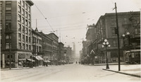
 No Caption: Seattle street scene, c. 1935.
-
 McCarthy Album 10, Photograph 207
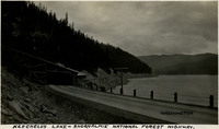
 Caption: "Keechelus Lake - Snoqualmie National Forest Highway," c. 1935.
-
 McCarthy Album 10, Photograph 206
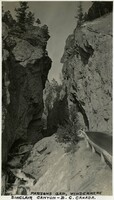
 Caption: "Parson's Gap, Windermere Sinclair Canyon - B.C. Canada," c. 1935.
-
 McCarthy Album 10, Photograph 205
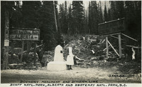
 Caption: "Boundary monument and division line. Banff Natl. Park, Alberta, and Kootenay Natl. Park, B.C., Canada," c. 1935, shows Grace McCarthy standing by the monument and dividing line between the national parks in Alberta and British Columbia.
-
 McCarthy Album 10, Photograph 204
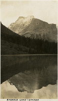
 Caption: "Emerald Lake - Canada," c. 1935.
-
 McCarthy Album 10, Photograph 203
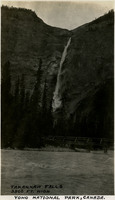
 Caption: "Takakkaw Falls 3500 ft. high. Yoho National Park, Canada," c. 1935.
-
 McCarthy Album 10, Photograph 202
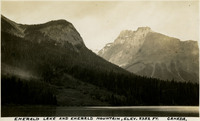
 Caption: "Emerald Lake and Emerald Mountain, elev. 8352 ft. Canada," c. 1935, located in Yoho National Park, British Columbia.
-
 McCarthy Album 10, Photograph 201
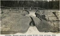
 Caption: "Natural Bridge - Kicking Horse River - Yoho National Park, B.C., Canada," c. 1935, shows Grace and William McCarthy standing on the bridge over the Kicking Horse River.
-
 McCarthy Album 10, Photograph 200
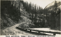
 Caption: "Yoho National Park - British Columbia, Canada. Switchback in the highway. 200 ft. climb in 1/3 mile," c. 1935.
-
 McCarthy Album 10, Photograph 199
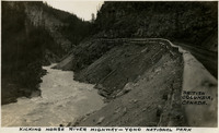
 Caption: "Kicking Horse River Highway - Yoho National Park. British Columbia, Canada," c. 1935.
-
 McCarthy Album 10, Photograph 198
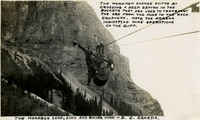
 Caption: "The Monarch Lead, Zinc, and Silver Mine - B.C. Canada. The workmen change shifts by crossing a deep canyon in the buckets that are used to transport the ore from the mine to the rock crushers. Note the arrows indicating mine operations on the cliff," c. 1935.
-
 McCarthy Album 10, Photograph 197
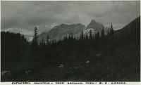
 Caption: "Cathedral Mountain - Yoho National Park - B.C. Canada," c. 1935.
-
 McCarthy Album 10, Photograph 196
 Caption: "Kicking Horse Pass or Great Divide - Line dividing Banff Natl. Park, Alberta and Yoho Natl. Park, B.C.. Alt. 5332 FT. July," c. 1935.
-
 McCarthy Album 10, Photograph 195
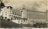
 Caption: "Lake Louise Chateau - Alberta, Canada," c. 1935 shows the luxury hotel, originally built by the Canadian Pacific Railway as a base for outdoor enthusiasts in 1890. The hotel is located in Banff National Park.
-
 McCarthy Album 10, Photograph 194
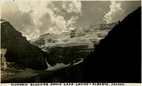
 Caption: 'Victoria Glaciers above Lake Louise - Alberta, Canada," c. 1935.
-
 McCarthy Album 10, Photograph 193
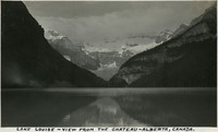
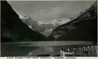
 Caption: "Lake Louise - View from the Chateau - Alberta, Canada," c. 1935.
-
 McCarthy Album 10, Photograph 192
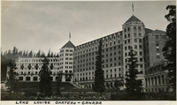
 Caption: "Lake Louise Chateau - Canada," c. 1935 shows the luxury hotel, originally built by the Canadian Pacific Railway as a base for outdoor enthusiasts in 1890. The hotel is located in Banff National Park.
-
 McCarthy Album 10, Photograph 191
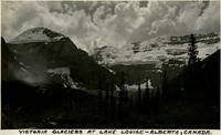
 Caption: "Victoria Glaciers at Lake Louise - Canada," c. 1935.
-
 McCarthy Album 10, Photograph 190
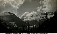
 Caption: "Victoria Glaciers at Lake Louise - Alberta, Canada," c. 1935.
-
 McCarthy Album 10, Photograph 189
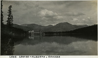
 Caption: "Lake Louise - Alberta, Canada," c. 1935, shows the luxury Chateau Lake Louise Hotel in the distance.
-
 McCarthy Album 10, Photograph 188
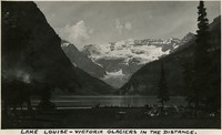
 Caption: "Lake Louise - Victoria Glaciers in the distance," c. 1935.
-
 McCarthy Album 10, Photograph 187
 Caption: "Lake Louise - view from Chateau - Alberta, Canada," c. 1935.
-
 McCarthy Album 10, Photograph 186
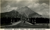
 Caption: "Cascade Mountain Elev. 9840 ft. Entering Banff from the west - Alberta, CA.," c. 1935.
-
 McCarthy Album 10, Photograph 185
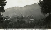
 Caption: "The Beautiful C.P.R.R. Banff Springs Hotel, Banff, CA.," c. 1935. Built by the Canadian Pacific Railway at the instigation of its president, William Cornelius Van Horne, the luxury Banff Springs Hotel originally opened in 1888 to welcome visitors travelling on the railway. The hotel was renovated and expanded through the years and today is a National Historic Site of Canada, located in Banff National Park, Canada's first National Park.
-
 McCarthy Album 10, Photograph 184
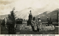
 Caption: "In the Banff Springs Hotel Grounds, Banff, Canada," c. 1935, shows William and Grace McCarthy sitting near a fountain on the grounds of the hotel.
-
 McCarthy Album 10, Photograph 183
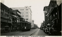
 Caption: "Eighth Avenue - Calgary - Alberta -Canada," c. 1935.
-
 McCarthy Album 10, Photograph 182a
 No Caption: A Canadian Pacific Banff Springs Hotel sticker, from the McCarthy's' trip to western Canada, 1935.
-
 McCarthy Album 10, Photograph 182
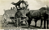
 Caption: "Indians of the Blood Tribe - Alberta, Canada. The Grandfather, and his son, with six children and wife," c. 1935, shows the Blood Indian family riding in a horse-drawn wagon.
-
 McCarthy Album 10, Photograph 181
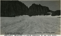
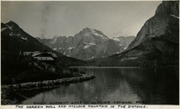
 Caption: "Grinnell Glacier - A solid mountain of ice and snow. A close up view of the Garden Wall, Glacier National Park," c. 1935.
-
 McCarthy Album 10, Photograph 180
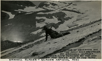
 Caption: "Grinnell Glacier - Glacier National Park. Method of observing one of the many deep crevasses on Grinnell Glacier. Your life depends on the man on the other end of the rope." c. 1935. William McCarthy tied to a rope and looking into a crevasse on Grinnell Glacier.
-
 McCarthy Album 10, Photograph 179
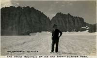
 Caption: "On Grinnell Glacier. The solid mountain of ice and snow - Glacier Park," c. 1935, shows William McCarthy standing on Grinnell Glacier.
-
 McCarthy Album 10, Photograph 178
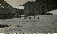
 Caption: "Hiking party on Grinnell Glacier - Glacier National Park. A solid block of ice covering many acres," c. 1935.
-
 McCarthy Album 10, Photograph 177
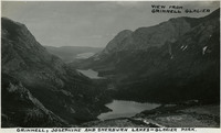
 Caption: "View from Grinnell Glacier. Grinnell, Josephine and Sherburn Lakes - Glacier Park," c. 1935.
-
 McCarthy Album 10, Photograph 176
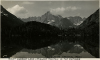
 Caption: "Swift Current Lake - Glacier National Park, the Garden Wall and McCloud Mountain in the distance," c. 1935.
-
 McCarthy Album 10, Photograph 175
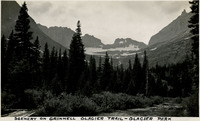
 Caption: "Scenery on Grinnell Glacier Trail - Glacier Park," c. 1935.
-
 McCarthy Album 10, Photograph 174
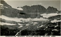
 Caption: "Approaching Grinnell Glacier - Glacier National Park," c. 1935.
-
 McCarthy Album 10, Photograph 173
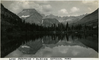
 Caption: "Lake Josephine-Glacier National Park," c. 1935.
-
 McCarthy Album 10, Photograph 172
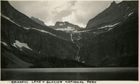
 Caption: "Grinnell Lake - Glacier National Park," c. 1935.
-
 McCarthy Album 10, Photograph 171
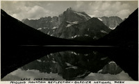
 Caption: "Lake Josephine. McCloud Mountain reflection - Glacier National Park," c. 1935.
-
 McCarthy Album 10, Photograph 170
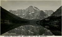
 Caption: "Lake Josephine, McCloud Mountain and Garden Wall in the distance. Glacier National Park," C. 1935.
-
 McCarthy Album 10, Photograph 169
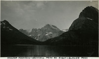
 Caption: "McCloud Mountain-Grinnell Peak on right, Swift Current Lake, Glacier National Park," c. 1935.
-
 McCarthy Album 10, Photograph 168
 Caption: "Swift Current Lake - McCloud Mountain in the distance, Glacier National Park," c. 1935.
-
 McCarthy Album 10, Photograph 167
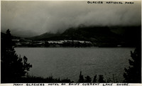
 Caption: "Many Glaciers Hotel on Swift Current Lake Shore, Glacier National Park," c. 1935.
-
 McCarthy Album 10, Photograph 166
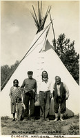
 Caption: "Blackfeet Indians. Glacier National Park," c. 1935, shows a woman, a young child, and three men of the Blackfeet Nation standing in front of a teepee.
-
 McCarthy Album 10, Photograph 165
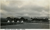
 Caption: "Glacier National Park Hotel," c. 1935.
-
 McCarthy Album 10, Photograph 164
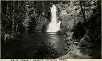
 Caption: "Trick Falls-Glacier National Park," c. 1935.
-
 McCarthy Album 10, Photograph 163
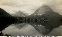
 Caption: "Two Medicine Lake and Rockwell Mountain - Glacier Park," c. 1935.
-
 McCarthy Album 10, Photograph 162
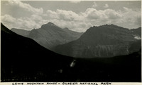
 Caption: "Lewis Mountain Range - Glacier National Park," c. 1935.
-
 McCarthy Album 10, Photograph 161
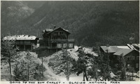
 Caption: "Going to the Sun Chalet - Glacier National Park," c. 1935.
-
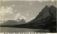 McCarthy Album 10, Photograph 160
 Caption: "Saint Mary's Lake and going to the Sun Mountain. Glacier National Park," c. 1935.