Items
Search full-text
William M. McCarthy Photograph Collection
-
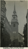 McCarthy Album 11, Photograph 240 Caption: "Historic North Church, Boston. Where Signal was Hung for Paul Revere, Sept. 5, 1934." View of the clock tower and steeple of the Old North Church, built in 1723. The church is said to be the site where Paul Revere, after his famous midnight ride, caused two lanterns to be hung as the signal that British troops were advancing into the area by sea rather than by land.
 -
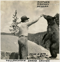 McCarthy Album 10, Photograph 138 Caption: "Another Highway Beggar. Have a bite bruin. Yellowstone Grand Canyon," c. 1935.
 -
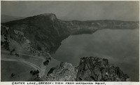 McCarthy Album 10, Photograph 264 Caption: "Crater Lake, Oregon - View from Watchman Point," c. 1935. Located in the Crater Lake National Park, Crater Lake is a caldera lake formed about 7,700 years ago by the collapse of the volcano, Mount Mazama. Its 1,949 foot depth makes it the deepest lake in U.S.
 -
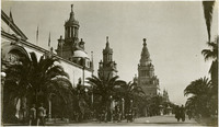 McCarthy Album 01, Photograph 021 No Caption: Avenue of the Palms at the Panama-Pacific International Exposition with people strolling and riding in rolling chairs.
 -
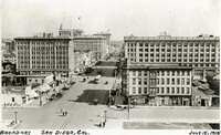 McCarthy Album 01, Photograph 149 Caption: "Broadway San Diego, Cal., July 18, 1915." Broadway street scene with commercial and residential buildings, streetcars, automobiles, and pedestrians.
 -
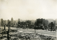 McCarthy Album 02, Photograph 027 No Caption: A view of San Francisco in ruins after the 1906 earthquake and fires devastated the city.
 -
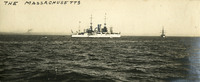 McCarthy Album 03, Photograph 071 Caption: "The Massachusetts," Ship designed for coastal defense. Unidentified location, undated.
 -
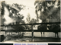 McCarthy Album 08, Photograph 197 Caption: "OSTRICH FARM, Pasadena, California.," c. 1905. View of several ostriches in a corral at the Caswston Ostrich Farm in Pasadena. Opened by Edward Cawston in 1886, this was the first ostrich farm in the U.S. It became a popular tourist stop along the Pasadena and Los Angeles Electric Railway in the early twentieth century, where visitors could ride an ostrich, or be pulled by one in a light card. They could also buy merchandise made out of ostrich feathers, such as hats and boas. The farm closed in the mid-1930s.
 -
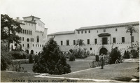 McCarthy Album 10, Photograph 011 Caption: "Santa Barbara Court House," c. 1935, shows a view of the courthouse's landscaped grounds.
 -
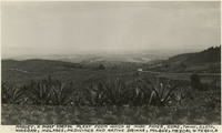 McCarthy Album 10, Photograph 388 Caption: "Maguey, a most useful plant from which is made paper, rope, twine, cloth, vinegar, molases [sic], medicine and native drinks, pulque, mezcal & tequila."
 -
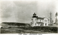 McCarthy Album 05, Photograph 240 Caption: "Fort Casey Lighthouse, Wash.," c. 1909. View of the lighthouse with fort buildings in the background. Located on Whidbey Island in Puget Sound, the Admiralty Head Lighthouse was built overlooking Admiralty Inlet in 1903. It replaced an earlier structure that had to be moved in 1890 to accommodate the construction of Fort Casey. The second lighthouse, shown here, was built with thick walls in order to withstand earthquakes and the concussion of guns at Fort Casey. Deactivated in 1922, the lighthouse has since been restored by Washington State Parks, and is part of the Fort Casey State Park.
 -
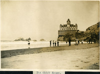 McCarthy Album 06, Photograph 055 Caption: "The Cliff House," c. 1906, shows several people on Ocean Beach with the third Cliff House that was built on that site in the distance, which burned down in 1907.
 -
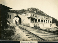 McCarthy Album 06, Photograph 179 Caption: "Tamalpais Tavern," c. 1907. The Tamalpais Tavern opened in 1896 on top of Mount Tamalpais and quickly became a popular destination for Bay Area residents who rode the Muir Woods Railway up and down the mountain. A fire destroyed the tavern in 1923 and a smaller, more modest building was erected in 1924 but closed at the start of World War II.
 -
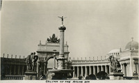 McCarthy Album 07, Photograph 059 Caption: "Column of the Rising Sun," (Adolph A. Weinman, sculptor), at the Panama-Pacific International Exposition.
 -
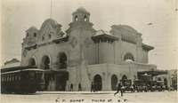 McCarthy Album 07, Photograph 187 Caption: "S.P. Depot, Third St. S.F.," c. 1915, shows the Southern Pacific Railroad Depot on Third and Townsend Streets in San Francisco. The mission revival architectural - style depot was built as a temporary structure in 1914 to serve the 1915 Panama-Pacific International Exposition. It remained in service for almost sixty years before it was demolished and replaced by a new station on 4th and King Streets in 1975-1976.
 -
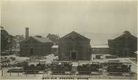 McCarthy Album 07, Photograph 315 Caption: "Benicia Arsenal Shops," c. 1915, shows three large structures surrounded by assorted machinery and equipment at the Benicia Arsenal.
 -
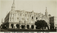 McCarthy Album 11, Photograph 118 Caption: "Spanish Club Building -- Havana -- Cuba. July 4, 1934." View of the Centro Gallago, now called "Gran Teatro de La Habana," or "Great Theatre of Havana," completed in 1915. It serves as the headquarters for the Cuban National Ballet Company.
 -
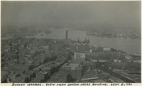 McCarthy Album 11, Photograph 241 Caption: "Boston Harbor. View from Custom House Building. Sept 5, 1934." Bird's eye view of Boston Harbor and surrounding port and wharf facilities.
 -
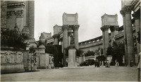 McCarthy Album 01, Photograph 022 No Caption: Visitors admiring the statuary near the Palace of Fine Arts, at the Panama-Pacific International Exposition.
 -
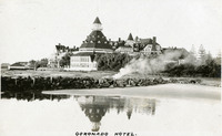 McCarthy Album 01, Photograph 150 Caption: "Coronado Hotel." The Hotel Del Coronado in San Diego County opened in 1888. It was designated a California Historic Landmark in 1970, and a National Historic Landmark in 1977.
 -
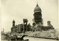 McCarthy Album 02, Photograph 028 No Caption: The San Francisco City Hall in ruins after the 1906 earthquake and resulting fires.
 -
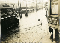 McCarthy Album 03, Photograph 072 Caption: "Fillmore St. Dec 10, 1906." Shows the Fillmore Street area flooded, San Francisco, 1906.
 -
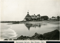 McCarthy Album 08, Photograph 198 Caption: "Coronado Hotel, San Diego, Cal.," c. 1910-1913. View of the Coronado Hotel, with beach in the foreground. At the time it opened in 1888, this hotel was the largest beach resort in the world. The Ballroom Tower, the highest point of the building, is 120 feet tall. See also 96-07-08-alb05-201.
 -
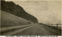 McCarthy Album 10, Photograph 012 Caption: "California Coast Highway - Oxnard to Santa Monica, May 24, 1935."
 -
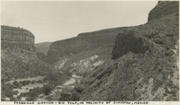 McCarthy Album 10, Photograph 389 Caption: "Tasquillo Canyon - Rio Tula, in vicinity of Zimipan, Mexico."
 -
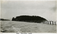 McCarthy Album 05, Photograph 241 Caption: "Fort Whitman, Wash," c. 1910. View of Goat Island in Puget Sound, Washington. Goat Island was the location of Fort Whitman, a small coastal defense fortification built in 1909. The fort consisted of a single battery and a mine field patrol and observation outpost. The buildings were torn down in 1945 at the conclusion of World War II.
 -
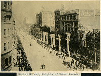 McCarthy Album 06, Photograph 056 Caption: "Market Street, Knights of Honor Parade," the Knights of Honor were a fraternal and secret society in the United States during the 19th and early 20th century. A Knights of Honor Grand Lodge was established in San Francisco in 1880, and at one time twenty subordinate lodges existed.
 -
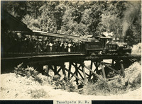 McCarthy Album 06, Photograph 180 Caption: "Tamalpais R.R." c. 1907. A view of the Muir Woods Railway, established in 1896 as a scenic tourist railway between Mill Valley and the east peak of Mount Tamalpais in Marin County.
 -
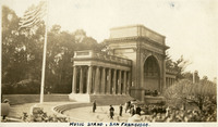 McCarthy Album 09, Photograph 002 Caption: "Music Stand, San Francisco." View of the Spreckels Temple of Music in San Francisco's Golden Gate Park, commonly known as the Music Stand or the Bandshell. The Temple was built in 1899-1900 at the west end of the park's Music Concourse. A gift to the City of San Francisco from sugar magnate Claus Spreckels, the Temple has been extensively renovated over the years to repair earthquake damage.
 -
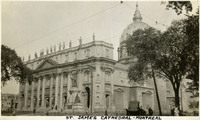 McCarthy Album 09, Photograph 129 Caption: "St. James Cathedral - Montreal," c. 1925. The St. James Cathedral in Montreal was consecrated in 1894. At that time, it was the largest church in Quebec. Pope Pious XII rededicated the church in 1955 to Mary, Queen of the World. See also 96-07-08-alb04-092.
 -
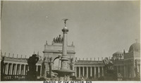 McCarthy Album 07, Photograph 060 Caption: "Column of the Setting Sun," or, Descending Night (Adolph A. Weinman, sculptor), at the Panama-Pacific International Exposition.
 -
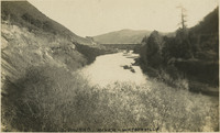 McCarthy Album 07, Photograph 188 Caption: "Pajaro River-Watsonville," c. 1910, shows a railroad trestle in the distance over the Pajaro River in Watsonville, Santa Cruz County. See also 96-07-08-alb02-019.
 -
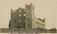 McCarthy Album 07, Photograph 316 Caption: "Benicia Arsenal Storehouse Ruins," c. 1915, shows some remaining walls of the Benicia Arsenal storehouse, which suffered damage from a 1912 explosion.
 -
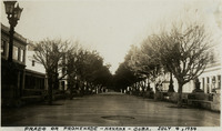 McCarthy Album 11, Photograph 119 Caption: "Prado or Promenade -- Havana -- Cub. July 4, 1934." Street scene, with a wide street lined with marble benches and trees on both sides. The Paseo del Prado is the oldest paved street in Havana, marking the line between Centro Habana and Old Havana. Its route was established in 1772 by Don Felipe Fonsdeviela y Ondeano. The street was redesigned in 1925 by landscape architect Jean-Claude Nicolas Forestier (who added the trees and marble benches).
 -
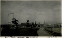 McCarthy Album 11, Photograph 242 Caption: "Longfellow Bridge, Boston, Mass. Sept. 5, 1934." The Longfellow Bridge spans the Charles River between Boston and Cambridge. Originally called the Cambridge Bridge, it replaced a wood structure called the West Boston Bridge that had been constructed in 1793. This wood bridge was unable to handle large volumes of traffic or the introduction of street cars, so a new bridge was built in the early twentieth century. Opened in 1906 as the Cambridge Bridge, the name was changed in 1927 to the Longfellow Bridge in honor of poet Henry Wadsworth Longfellow. It is colloquially known as the Salt and Pepper Bridge, as its central towers are reminiscent in shape of salt and pepper shakers.
 -
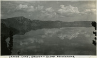 McCarthy Album 10, Photograph 266 Caption: "Crater Lake, Oregon - cloud reflections," c. 1935.
 -
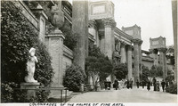 McCarthy Album 01, Photograph 023 Caption: "Colonnades of the Palace of the Fine Arts," at the Panama-Pacific International Exposition.
 -
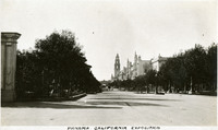 McCarthy Album 01, Photograph 151 Caption: "Panama-California Exposition," held in Balboa Park, San Diego, California.
 -
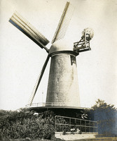 McCarthy Album 05, Photograph 113 No caption, c. 1910. Image of the Dutch Windmill in Golden Gate Park, built in 1903 to pump ground water within the park for irrigation purposes.
 -
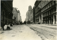 McCarthy Album 02, Photograph 029 No Caption: A view of the reconstruction on Market Street after the 1906 earthquake and fires, c. 1907.
 -
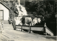 McCarthy Album 03, Photograph 073 Caption: "Shasta Springs," Siskiyou County, California, c. 1906. Shasta Springs, just north of Dunsmuir, California, in the Trinity Mountains, was a resort area in the late nineteenth and early twentieth centuries. It centered around natural springs, which became a featured stop on the Southern Pacific Railroad's Shasta Route. The resort operated until the 1950s, when it was purchased by private interests.
 -
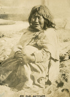 McCarthy Album 08, Photograph 076 Caption: "An Old Settler.," undated. Shows an unidentified elderly woman, possibly Native American in ethnicity.
 -
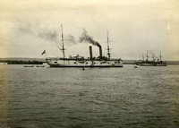 McCarthy Album 08, Photograph 199 No Caption: c. 1905. View of several ships in San Diego Harbor.
 -
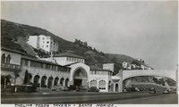 McCarthy Album 10, Photograph 013 Caption: "Thelma Todd's Tavern - Santa Monica," c. 1935. Built in 1928 for Hollywood actress Thelma Todd, the restaurant overlooked the Pacific Ocean at Malibu. Todd lived in the home above the tavern, where she was found dead in December 1935, under mysterious circumstances.
 -
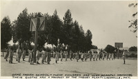 McCarthy Album 10, Photograph 390 Caption: "Otme [sic] Indian School - these children are very scantily dressed. Their clothes are a product of the Maguey plant - Lagunilla, Mex."
 -
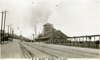 McCarthy Album 05, Photograph 242 Caption: "R.R. Depot -- Everett, Wash.," c. 1910. View of the Great Northern Railway Station in Everett, Washington, also known as the Bond Street Station, built by the Great Northern Railway in 1910.
 -
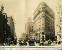 McCarthy Album 06, Photograph 057 Caption: Market Street, Call, Chronicle, Palace, Grand, & Crocker Buildings," c. 1906, shows a bustling scene of tall buildings, people, horses and buggies, and a trolley on Market Street.
 -
 McCarthy Album 06, Photograph 181.0 Caption: "Tamalpais Views," is a label for photographs 179 - 184 in album 6, showing a variety of views of Mount Tamalpais in Marin County.
 -
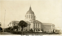 McCarthy Album 09, Photograph 003 Caption: "City Hall, San Francisco.," c. 1925. View of the Beaux Arts-style building that replaced San Francisco's City Hall after the original building was destroyed in the 1906 earthquake and fire. Designed by architect Arthur Brown, Jr., the building occupies two full city blocks. See also 96-07-08-alb09-005, 96-07-08-alb10-001, and 96-07-08-alb11-001.
 -
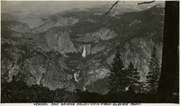 McCarthy Album 09, Photograph 257 Caption: "Vernal and Nevada Falls - View From Glacier Point," c. 1917. Both Vernal Fall (bottom center) and Nevada Fall (middle) are observable from this vantage point at Glacier Point.