Items
Search full-text
William M. McCarthy Photograph Collection
-
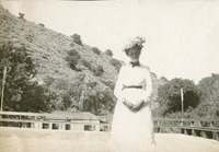 McCarthy Album 06, Photograph 112 No caption. An unidentified woman poses for a photograph in white dress and flower adorned hat at what is likely the Alhambra Springs of Alhambra Creek in Contra Costa County, c. 1906.
 -
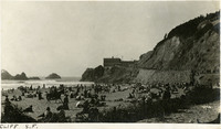 McCarthy Album 03, Photograph 003 Caption: "Cliff S.F." The Cliff House and Ocean Beach in San Francisco shows people on the beach and walking up the road to the Cliff House, c. 1910. The photograph shows the third Cliff House built on this site, which opened in 1909, and was built with steel-reinforced concrete. The original Cliff House was built in 1863 and was destroyed by fire on Christmas day in 1894. The second, Victorian- style Cliff House was completed in 1896, and although it survived the 1906 earthquake and fires, it burned to the ground in 1907 (see 96-07-08-alb06-280).
 -
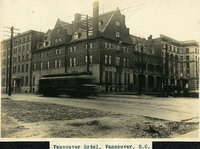 McCarthy Album 08, Photograph 007 Caption: "Vancouver Hotel, Vancouver, B.C.," c. 1908-1912. View of the Hotel Vancouver, designed by architect T.C. Sorly for the Canadian Pacific Railway (CPR). This photograph shows the first building on the site, which opened in 1888. By 1916, the area had grown so much that the CPR razed this building and constructed a new, larger, more modern facility.
 -
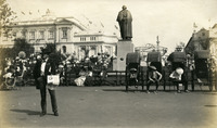 McCarthy Album 08, Photograph 131 No Caption: A statue of George Washington (Lorado Taft, artist) dominates this photograph of fair-goers at the Alaska-Yukon-Pacific Exposition. Rickshaws and their drivers rest near the statue while waiting for their next fare. Held in Seattle to celebrate the development of the Pacific Northwest, the fair attracted 3.7 million visitors over the course of its run from June to October 1909. Although most of the fair's buildings have since been destroyed, several of them now serve as part of the University of Washington campus.
 -
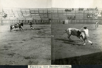 McCarthy Album 08, Photograph 258 Caption: "Placing the Bandarillias [sic]." Two images pasted into the photograph album next to each other, both showing bulls in a bullring. In both photographs, banderilleros are attempting to place banderillas (short barbed sticks) in each bull's shoulders.
 -
 McCarthy Album 11, Photograph 051 Caption: "Street Scene -- New Orleans, June 15, 34." Street scene with two lines of railroad tracks in the center of the photograph, running into the distance. Automobile traffic can be seen on the roads to either side of the tracks.
 -
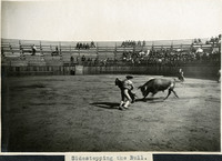 McCarthy Album 08, Photograph 259 Caption: "Sidestepping the Bull." In this photograph, a bull attempts to gore a matador holding a cape, observed by dozens of people in the surrounding stands.
 -
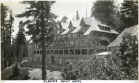 McCarthy Album 09, Photograph 317 Caption: "Glacier Point Hotel," c. 1917. The 80-room chalet-style Glacier Point Hotel opened in 1918, located 3,218 feet above the floor of Yosemite Valley on Glacier Point. This photograph shows the back side of the building, with a viewing porch that looked out over the valley. The building was destroyed by an electrical fire in July 1969.
 -
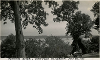 McCarthy Album 11, Photograph 179 Caption: "Potomac River, View from Mt. Vernon. July 22, 1934." Trees obscure much of the photograph, but the Potomac River can be glimpsed in the distance.
 -
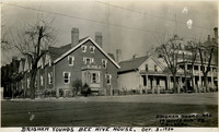 McCarthy Album 11, Photograph 301 Caption: "Brigham Youngs [sic] Bee Hive House. Brigham Young had 19 Wives and 52 Children. Oct. 3, 1934." Street scene in Salt Lake City, Utah. Brigham Young, founder of the Church of Jesus Christ of Latter Day Saints built the so-called "Beehive House" in 1854 to house himself and several of his wives (Young practiced polygamy). The Beehive House is visible in the photograph at the far right, with a widow's walk featured on its roofline. Designed by Salt Lake Temple architect Truman O. Angell, the Beehive House has since been used as a residence for several dignitaries of the Mormon Church, as well as a boarding home for young Mormon women. The house was restored in the late 1950s and is now a museum. See also 96-07-08-alb11-301.
 -
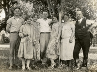 McCarthy Album 04, Photograph 246 No caption, c. 1920. Group of unidentified people posing in a park-like setting.
 -
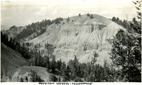 McCarthy Album 09, Photograph 063 Caption: "Mountain Scenery - Yellowstone," c. 1923. A domed mountain dominates this photograph, with sheer rocky cliffs and other geologic formations on its flanks.
 -
 McCarthy Album 11, Photograph 053 Caption: "New Orleans Iron Fence Made to Represent Corn. June 16, 34." The iron pickets and vertical rails of the fence in this photograph have been shaped to look like stalks of corn, complete with ears and leaves.
 -
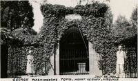 McCarthy Album 11, Photograph 180 Caption: "George Washingtons [sic] Tomb, Mount Vernon, Virginia, July 22, 1934." The gated entrance to the tomb holding the remains of George Washington are seen in this photograph, overgrown by ivy. Two unidentified people stand at either side of the entry. The brick tomb was constructed after Washington's death in 1799.
 -
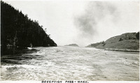 McCarthy Album 05, Photograph 176 Caption: "Deception Pass -- Wash.," c. 1909. View of the strait known as Deception Pass, separating Whidbey Island from Fidalgo Island in Puget Sound. Deception Island can be seen in the center of the photograph in the distance. See also 96-07-08-alb08-094.
 -
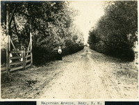 McCarthy Album 08, Photograph 261 Caption: "Hagerman Avenue, Eddy, N. M.," c. 1905. view of a country road lined with bushes or trees, in Eddy County, New Mexico. An unidentified woman stands in the center of the photograph in the middle distance.
 -
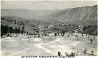 McCarthy Album 09, Photograph 064 Caption: "Government Headquarters," c. 1923. Bird's eye view of the Mammoth Hot Springs Hotel (the large, flat-roofed building in the center of the photograph) and surrounding complex of buildings in Yellowstone National Park.
 -
 McCarthy Album 11, Photograph 054 Caption: "Cabildo or Old Spanish Jail and St. Louis Cathedral -- New Orleans, June 16, 34." The façade of the Cabildo dominates this photograph, while the corner of St. Louis Cathedral is visible at the right. The Cabildo was the seat of government for New Orleans while the area was under Spanish jurisdiction. The building was also the site of the transfer ceremonies when the U.S. purchased the Louisiana Territory from France in 1803. Although damaged by fire in 1988, the restored Cabildo survived Hurricane Katrina in 2005 with only minor damage.
 -
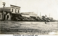 McCarthy Album 04, Photograph 120 Caption: "Tiajuana [sic] on a Winters Day," c. 1915-1916. Rainy street scene in Tijuana, showing Miguel Gonzalez Big Curio Store and Tijuana Bar and Casino.
 -
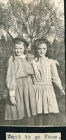 McCarthy Album 06, Photograph 117 Caption: "Want to go home," c. 1906, shows two unidentified young girls posing for a photograph.
 -
 McCarthy Album 11, Photograph 055 Caption: "First Apt. House in America -- New Orleans -- Jun 16, 34." One of the Pontalba Buildings occupies the right side of this photograph. These large, matching, red brick buildings, constructed in the late 1840s by Baroness Micaela Almonester Pontalba, form two sides of Jackson Square in New Orleans' French Quarter. Popular belief holds that these are the oldest continuously-rented apartment buildings in the U.S. However, that assertion has been challenged by historians who state that the buildings served as row houses for almost a century, not functioning as apartment buildings until the 1930s.
 -
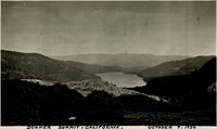 McCarthy Album 11, Photograph 305 Caption: "Donner Summit, California. October 7, 1934." Panoramic view of Donner Lake and the surrounding mountains. A highway can be glimpsed running through the lower half of the photograph.
 -
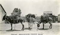 McCarthy Album 04, Photograph 122 Caption: "Freight Transportation -- Tiajuana [sic], Mexico," c. 1915-1916. Three donkeys loaded with packs of what appear to be firewood.
 -
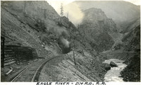 McCarthy Album 09, Photograph 067 Caption: "Eagle River - D. & R. G. R. R," c. 1923. Denver and Rio Grande Western Railroad tracks run next to the Eagle River at the bottom of a canyon in this photograph, toward a tunnel with steam or smoke coming out of the entry. The Denver and Rio Grande (D&RG) primarily operated railroad lines between Denver, Colorado and Salt Lake City, Utah, with other lines stretching into New Mexico.
 -
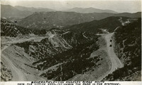 McCarthy Album 04, Photograph 123 Caption: "Bakersfield-Los Angeles Ridge Route. Note the winding road. (X) marks the road in the distance." c. 1920. Mountain scene showing road winding around hills and ridges, with a few scattered automobiles also present. First opened in 1915, the Ridge Route was the first paved highway connecting Los Angeles with the San Joaquin Valley.
 -
 McCarthy Album 11, Photograph 088 Caption: "Ringling Museum -- Sarasota -- Florida, June 28 1934." Entrance to the John and Mable Ringling Museum of Art, Florida's state art museum established by John and Mable Ringling in 1927. John was a promoter and part-owner of the famous Ringling Brothers Circus, along with four of his brothers. When John and Mable built a winter home in Sarasota in 1926, they also explored the possibility of establishing an art gallery on the same property. Architect John H. Phillips designed the building, which opened to the public in 1931. John Ringling willed the facility and the art collection to the state of Florida upon his death in 1936. The museum, now known simply as "The Ringling," is under the jurisdiction of the University of Florida.
 -
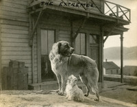 McCarthy Album 06, Photograph 120 Caption: "The Extremes," c. 1906, shows one large dog and one small dog, in front of a building at an unidentified location.
 -
 McCarthy Album 06, Photograph 246 No Caption. An unidentified man riding a horse at an unidentified location, c. 1920.
 -
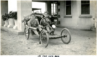 McCarthy Album 09, Photograph 196 Caption: "In The Red Bug." Two unidentified boys pose in a small go-cart near the carport in front of the John Shields residence, in the Daybreak Estate area of Long Island.
 -
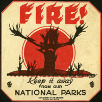 McCarthy Album 09, Photograph 321b This warning sticker advertises "FIRE! Keep it away form our National Parks." The silhouette of a skeletal tree stretches bare branches toward the viewer.
 -
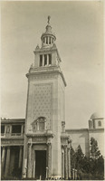 McCarthy Album 07, Photograph 127 Caption: "Italian Spire" in the Italian Pavilion, at the Panama-Pacific International Exposition.
 -
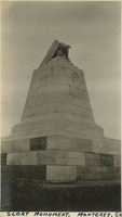 McCarthy Album 07, Photograph 255 Caption: "Sloat Monument. Monument, Cal," c. 1915, shows the Commodore John Drake Sloat monument in Monterey, California. The monument was constructed in 1910 and commemorates the taking possession of California from Mexico in 1846 by Sloat and his men at Monterey, which was the capital city of Alta California during the Mexican era.
 -
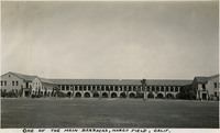 McCarthy Album 10, Photograph 080 Caption: "One of the Main Barracks, March Field, Calif.," c. 1935. Today known as March Air Reserve Base, March Field was one of several airfields established in April 1917, just after the United State's entry in World War 1. The airfield was named for Peyton C. March Jr., son of then Army Chief of Staff, Peyton C. March, who had been killed in an air crash just fifteen days after being commissioned.
 -
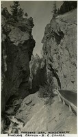 McCarthy Album 10, Photograph 206 Caption: "Parson's Gap, Windermere Sinclair Canyon - B.C. Canada," c. 1935.
 -
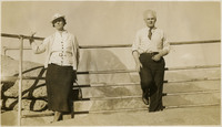 McCarthy Album 10, Photograph 333 No Caption: An unidentified woman and unidentified man at Yosemite National Park, c. 1935.
 -
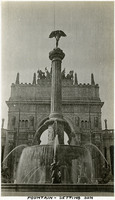 McCarthy Album 01, Photograph 090 Caption: "Fountain of the Setting Sun" or Descending Night (Adolph A. Weinman, sculptor), in the Court of the Universe, at the Panama-Pacific International Exposition.
 -
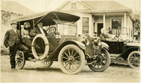 McCarthy Album 05, Photograph 310 No caption, c. 1915. Several unidentified people posing in two automobiles in front of a residence in Concord, California.
 -
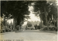 McCarthy Album 03, Photograph 012 Caption: "The Alameda of Presidio," c. 1910. Established in 1776 by Spanish explorers, the Presidio is a fortified location overlooking the Golden Gate, the entrance into San Francisco Bay. It was closed as a military structure in 1995, and is now a park within the Golden Gate National Recreation Area.
 -
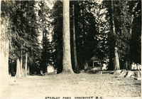 McCarthy Album 08, Photograph 016 Caption: "Stanley Park Vancouver B.C.," c. 1908-1912. View of what may be a campsite, surrounded by tall trees and featuring a small gazebo and bench. The City of Vancouver opened Stanley Park in 1888. The 405-hectare park is even now thickly forested, and remains Vancouver's largest park. It is located on the northern edge of the city, surrounded on three sides by Vancouver Harbor and English Bay.
 -
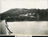 McCarthy Album 08, Photograph 140 Caption: "Fort Columbia, Wash.," c. 1910. Fort Columbia, built between 1896 and 1904, sits on Chinook Point overlooking the Columbia River. It is part of the Three Fort Harbor Defense System protecting the mouth of the river from enemy incursion or attack (the other forts being Oregon's Fort Stevens and Washington's Fort Canby). Fort Columbia was decommissioned after World War II, and is now the site of a Washington State Park.
 -
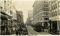 McCarthy Album 05, Photograph 181 Caption: "Washington St. Portland Or.," c. 1915. Street scene on Washington Street in Portland, Oregon, with an electric trolley, automobiles, and pedestrians. See also 96-07-08-alb08-092.
 -
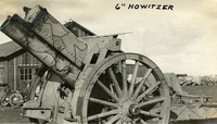 McCarthy Album 06, Photograph 121 Caption: "6" Howitzer," c. 1906. A piece of artillery characterized by a relatively short barrel, used for firing shells on high trajectories at low velocities.
 -
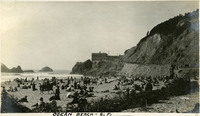 McCarthy Album 06, Photograph 247 Caption: "Ocean Beach - S.F," c. 1910, shows a large group of sunbathers on San Francisco's Ocean Beach.
 -
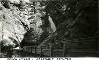 McCarthy Album 09, Photograph 069 Caption: "Seven Falls - Colorado Springs," c. 1923. View from the top of a narrow wooden staircase, looking back down onto a resort building and a small creek. The stairs lead to a series of seven cascading waterfalls of South Cheyenne Creek. The area has been a privately-owned tourist attraction since the 1880s.
 -
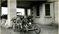 McCarthy Album 09, Photograph 197 Caption: "In The Red Bug." Two unidentified boys pose in a small go-cart near the carport in front of the John Shields residence, in the Daybreak Estate area of Long Island.
 -
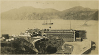 McCarthy Album 07, Photograph 001 Caption: "Fort Point." c. 1906. See also 96-07-08-alb06-009 with caption: "Fort Point and Golden Gate," and 96-07-08-alb03-118, San Francisco. Fort Point in the foreground, with ships in the bay. Fort Point was part of an effort by the U.S. government to protect the Golden Gate, entrance to the San Francisco Bay. Built between 1853-1861 of brick and mortar, the fort included emplacements for 141 guns but never fired a weapon in defense of the Bay.
 -
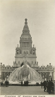 McCarthy Album 07, Photograph 128 Caption: "Fountain of Energy and Tower," shows the Fountain of Energy (A. Stirling Calder, sculptor), and the Tower of Jewels at the Panama-Pacific International Exposition.
 -
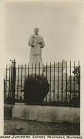 McCarthy Album 07, Photograph 256 Caption: "Padre Junipero Sierra [sic] Monument. Monterey," c. 1915, shows a monument commemorating the Spanish Franciscan priest, Father Junipero Serra, who led the founding and construction of the Spanish Mission system in Alta California during the Spanish era. The monument was commissioned and erected in 1891 by Jane Stanford of Stanford University and is listed on the National Register of Historic Places.
 -
 McCarthy Album 11, Photograph 186 Caption: "Congressional Library, Washington, D.C. July 25, 1934. Taken from Washington Capitol Dome." A view of the Library of Congress. The Beaux Arts-style building was constructed between 1888 and 1894. It serves as the national library of the U.S., as well as the research library for the U.S. Congress.
 -
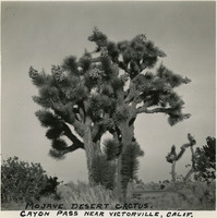 McCarthy Album 10, Photograph 081 Caption: "Mojave Desert Cactus. Cayon [sic] Pass near Victorville," c. 1935, shows a Joshua Tree in bloom on the Cajon Pass near Victorville.