Items
Search full-text
William M. McCarthy Photograph Collection
-
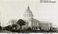 McCarthy Album 10, Photograph 001 Caption: "City Hall, San Francisco, Population in San Francisco 750,000, May 21, 1935." The date with which the photograph was labeled (May 21, 1935) does not appear to be accurate. The date is more likely circa 1925. See also 96-07-08-alb09-003 and 005, and 96-07-08-alb11-001.
 -
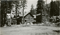 McCarthy Album 04, Photograph 047 No caption, c. 1927. A resort in the Sierra Nevada Mountains, near the California-Nevada border.
 -
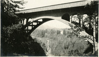 McCarthy Album 04, Photograph 174 No caption, c. 1915-1920. Shepperd's Dell Bridge, built in 1914, spans Young Creek along the Historic Columbia River Highway.
 -
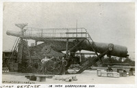 McCarthy Album 05, Photograph 102 Caption: "Coast Defense: 14 Inch Disappearing Gun." Another copy of a C.D. Heath photograph, this image shows a heavy artillery gun, with two unidentified men standing next to it, at the Sandy Hook Proving Ground. Located at Sandy Hook, New Jersey, the Sandy Hook Proving Ground was used by the U.S. Army to test ordinance and materiel from 1874-1919. See also 96-07-08-alb05-101.
 -
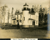 McCarthy Album 08, Photograph 065 Caption: "Fort Casey Light House [sic]," c. 1905. Located on Whidbey Island in Puget Sound, the Admiralty Head Lighthouse was built overlooking Admiralty Inlet in 1903. It replaced an earlier structure that had to be moved in 1890 to accommodate the construction of Fort Casey. The second lighthouse, shown here, was built with thick walls in order to withstand earthquakes and the concussion of guns at the fort. The man and woman shown in the photograph (standing with a dog) are likely Charles H. Davis and his second wife Delia (Overton) Davis. Charles Davis was appointed keeper of the lighthouse in 1900 and served until his death in 1914. The lighthouse, deactivated in 1922, has since been restored by Washington State Parks, and is part of the Fort Casey State Park. See also 96-07-08-alb02-057.
 -
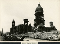 McCarthy Album 08, Photograph 188 Caption: "City Hall Ruins." Photograph of the former San Francisco City Hall building, destroyed in the 1906 earthquake and fire.
 -
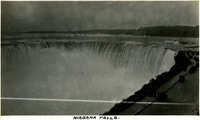 McCarthy Album 09, Photograph 119 Caption: "Niagara Falls," c. 1925. View of Horseshoe Falls, largest of the three waterfalls that make up the iconic Niagara Falls straddling the border between Ontario, Canada, and the State of New York. At the right side of the photograph is a parking area with groups of tourists taking in the view.
 -
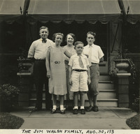 McCarthy Album 11, Photograph 232 Caption: "The Jim Walsh Family. Aug. 30, 193 [sic]." Jim Walsh (at left), his wife, and three children posing for a photograph in front of a covered patio.
 -
 McCarthy Album 06, Photograph 172.0 Label in photograph album for photographs 172 and 173: "City Hall Tower Before and after the Quake."
 -
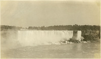 McCarthy Album 09, Photograph 120 No caption. c. 1925. View of the American Falls (widest waterfall in the photograph), and Bridal Veil Falls, two of the three waterfalls that make up the iconic Niagara Falls straddling the border between Ontario, Canada, and the State of New York.
 -
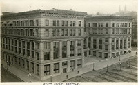 McCarthy Album 05, Photograph 104 Caption: "Court House -- Seattle.," c. 1916. The King County Courthouse in downtown Seattle, Washington, was built in 1916 as a five-story structure, as shown in this photograph. Six floors were added in 1930, and another three before 1965. In 1967, a massive remodeling project imposed aluminum curtain walls on the building's east and west sides, changed the main entryway switched to Third Avenue rather than Jefferson Street, and made other changes to the interior.
 -
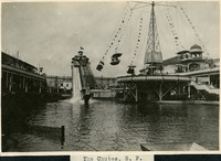 McCarthy Album 08, Photograph 190 Caption: "The Chutes, S. F.," c. 1905. View of the Fulton Street Chutes, a 350-foot water slide. Boats or toboggans careened down the slide into a man-made lake at the bottom. Such "chutes" were very popular throughout the U.S. and Europe at the turn of the century. The Fulton Street Chutes operated from 1902-1907 as part of an amusement park area that also featured the "Circle Swing Flying Machine" (also visible in the photograph), a theater, bar, merry-go-round, and a zoo.
 -
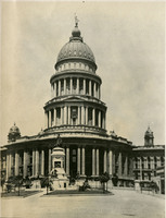 McCarthy Album 06, Photograph 172 No caption. Caption in photograph album (172.0): "City Hall Tower Before and after the Quake." 1906. A view of San Francisco City Hall before the April 18, 1906 earthquake.
 -
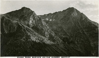 McCarthy Album 04, Photograph 050 Caption: "Tioga Road Scenes on the Sierra Summit." Two mountain peaks as seen from the Tioga Road.
 -
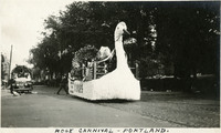 McCarthy Album 04, Photograph 177 Caption: "Rose Carnival -- Portland." Features a parade float shaped as a swan, with roses, an American flag, and a sign reading "peace." The Portland Rose Festival began in 1907 as the Rose Carnival. It is now an annual festival featuring three parades, including the Grand Floral Parade, the second-largest all-floral parade in the nation (the largest being the Tournament of Roses held each New Year in Pasadena, California).
 -
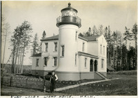 McCarthy Album 03, Photograph 065 Caption: "Fort Casey Light House, Wash." c. 1905. Located on Whidbey Island in Puget Sound, the Admiralty Head Lighthouse was built overlooking Admiralty Inlet in 1903. It replaced an earlier structure that had to be moved in 1890 to accommodate the construction of Fort Casey. The second lighthouse, shown here, was built with thick walls in order to withstand earthquakes and the concussion of guns at Fort Casey. The man shown in the photograph is likely Charles H. Davis, who was appointed keeper of the lighthouse in 1900 and served until his death in 1914. The lighthouse, deactivated in 1922, has since been restored by Washington State Parks, and is part of the Fort Casey State Park.
 -
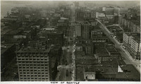 McCarthy Album 05, Photograph 234 Caption: "View of Seattle," c. 1915. Bird's eye view of Seattle's downtown area, possibly from the Smith Tower. Second Avenue runs down the center of the photograph.
 -
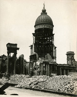 McCarthy Album 06, Photograph 173 No Caption: Caption in photograph album (172.0): "City Hall Tower Before and after the Quake." 1906. A view of San Francisco City Hall after the April 18, 1906 earthquake shows the devastation to the structure.
 -
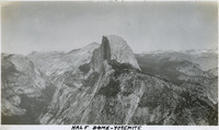 McCarthy Album 09, Photograph 249 Caption: "Half Dome - Yosemite," c. 1917. The iconic granite Half Dome rises above the Yosemite Valley. This photograph appears to have been taken from a neighboring peak.
 -
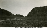 McCarthy Album 04, Photograph 051 Caption: "Devils Gate -- Nevada -- Elevation 7540 Feet." Devil's Gate is a rock formation near Silver City, Nevada. In the nineteenth century a portion of the formation was blasted away to create enough space for a wagon road, which became a toll road serving as an entryway to the Nevada silver fields.
 -
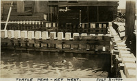 McCarthy Album 11, Photograph 113 Caption: "Turtle Pens -- Key West. July 2, 1934." View of turtle kraals, or turtle corrals, used in the turtle fishing industry in Key West. Green turtles were kept in these pens prior to slaughter or transport. Turtle meat and eggs were popular food items in the early-to-mid twentieth century; turtle fat was especially prized for making turtle soup. However, the turtle population plummeted in the Florida Keys and surrounding areas as the twentieth century progressed and demand increased. The turtle kraals and nearby canneries closed when the Endangered Species Act was passed in 1971. Populations have since started to recover. The cannery near the kraals shown in this photograph now serves as the Key West Turtle Museum.
 -
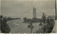 McCarthy Album 11, Photograph 236 Caption: "George Washington Bridge, Crossing the Hudson River, N.Y. Sept. 3, 1934." This suspension bridge, designed by Othmar Ammann, spans the Hudson River between Manhattan in New York City, and Fort Lee, New Jersey. Constructed between 1927 and 1931, the bridge included the longest main span in the world at the time, a record it held until construction of the Golden Gate Bridge was completed in 1937. It was originally built with only one deck (as seen in this photograph), but a second deck opened in 1962. Still in active use today, it carried over 51 million vehicles in 2016.
 -
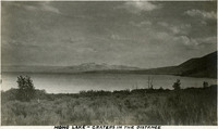 McCarthy Album 04, Photograph 052 Caption: "Mono Lake -- Craters in the Distance." Mono Lake, in Mono County, California, is a shallow saline lake used as a resting stop by almost two million migratory birds each year.
 -
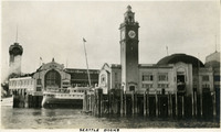 McCarthy Album 05, Photograph 236 Caption: "Seattle Docks," c. 1914. Dock facilities at Seattle, showing a clock tower, as well as the G.T.P., or Grand Trunk Pacific, dock, a shipping pier at the end of Madison Street (the G.T.P. watchtower is visible at the far left of the photograph). This dock, built in 1910, was destroyed by a fire on July 30, 1914. It was rebuilt, but without the watchtower, and served the city until 1964 when it was demolished.
 -
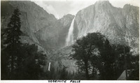 McCarthy Album 09, Photograph 251 Caption: "Yosemite Falls," c.1917. Both the Upper and Lower Yosemite Falls, on Yosemite Creek, are visible in this photograph, taken from the valley floor. The highest waterfall in Yosemite National Park, Yosemite Falls is made up of two successive cascades falling a total of 2,425 feet from the top of the Upper Fall to the base of the Lower Fall. The Upper Fall alone is 1,430 feet high, and is one of the top twenty highest waterfalls in the world.
 -
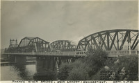 McCarthy Album 11, Photograph 237 Caption: "Thames River Bridge, New London, Connecticut. Where Harvard and Yale Hold their Annual Rowing Regatta, Sept. 4, 1934." View of two bridges over the Thames River near New London, Connecticut. The drawbridge in the foreground was originally a railroad bridge, built in the late nineteenth century. Later, as automobiles grew in popularity, this bridge was converted to use by vehicles (cars can be seen driving over it in this photograph), and a second bridge was constructed for railroad use (a locomotive can be seen behind the two cars). Neither of these bridges survives today, having been replaced by the Gold Star Memorial Bridge.
 -
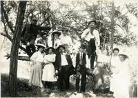 McCarthy Album 06, Photograph 052 No Caption: Group photograph of twelve unidentified individuals, likely friends and family of the McCarthys, posing on the branches of a tree at an unidentified location, c. 1908.
 -
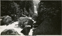 McCarthy Album 09, Photograph 252 Caption: "Vernal Falls [sic]," c. 1917. The Merced River tumbles over and around large chunks of rock in this photograph, with Vernal Fall visible in the distance.
 -
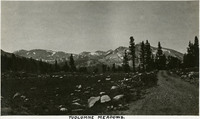 McCarthy Album 04, Photograph 054 Caption: "Tuolumne Meadows." Meadow area along the Tuolumne River in the eastern portion of Yosemite National Park, with mountains in the background. Tuolumne Meadows is recognized as one of the largest alpine meadows of the Sierra Nevada Mountains.
 -
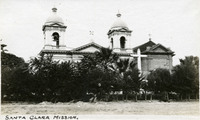 McCarthy Album 05, Photograph 109 Caption: "Santa Clara Mission," c. 1910. Founded in 1777, Mission Santa Clara featured several different churches over the years. This photograph shows the mission church as it appeared from roughly 1861 to 1926. In the 1860s, Santa Clara College President Burchard Villager decided to rebuild many of the buildings on the campus. In the process, the mission church was renovated in the Italianate style, with a second bell tower. This Italianate-style church burned in 1926. The church was then rebuilt as a modern reconstruction of the fifth church on the site, the original of which was destroyed by fire in 1825.
 -
 McCarthy Album 02, Photograph 025 No Caption: See also 96-07-08-alb08-183, with caption: "San Francisco April 18, 1906. Center of Town. The Awful Fire after the Shake." Fire engulfing buildings in San Francisco's city center after the 1906 earthquake. Great plumes of smoke dominate the photograph.
 -
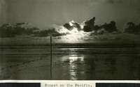 McCarthy Album 08, Photograph 072 Caption: "Sunset on the Pacific," c. 1908-1912. Photograph of the sun setting into clouds over the Pacific Ocean, likely near Port Townsend, Washington.
 -
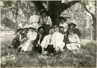 McCarthy Album 06, Photograph 053 No Caption. Group photograph of twelve unidentified individuals, and a small dog, likely friends and family of the McCarthys, posing at the base of a large oak tree at an unidentified location, c. 1908.
 -
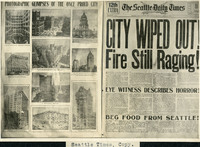 McCarthy Album 06, Photograph 177 Caption: "Seattle Times, Copy." Photograph of The Seattle Daily Times front page and photographs of the San Francisco earthquake's aftermath with headline: "City Wiped Out! Fire Still Raging!" Dated April 20, 1906.
 -
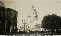 McCarthy Album 11, Photograph 116 Caption: "Capitol Building -- Havana, Cuba. July 4, 1934." The building seen in this photograph, reminiscent of the U.S. Capitol, served as Cuba's Capitol from its completion in 1929 until after the Cuban Revolution of 1959. Designed by Eugenio Rayneri Piedra, the building now houses the Cuban Academy of Sciences.
 -
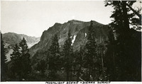 McCarthy Album 04, Photograph 055 Caption: "Moonlight Scene -- Sierra Summit." Rocky crag in the Sierra Nevada Mountains.
 -
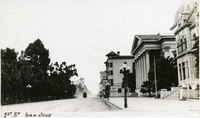 McCarthy Album 05, Photograph 110 Caption: "1st St San Jose," c. 1910. Street scene showing stately buildings on the right side of the photograph, while trees line the street on the left. A trolley car can be seen in the distance.
 -
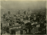 McCarthy Album 02, Photograph 026 No Caption: See also 96-07-08-alb08-182, with caption: "San Francsico April 17, 1906. Center of Town." Bird's eye view of the center of San Francisco before the 1906 earthquake and fire. The Call Building (built in the 1890s to house the San Francisco Call newspaper) is the tallest building in the photograph, just to the right of center.
 -
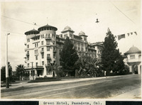 McCarthy Album 08, Photograph 196 Caption: "Green Hotel, Pasadena, Cal.," c. 1905. View of Castle Green, built as an annex to the Hotel Green in 1899. The original Hotel Green opened for business as a lavish resort in 1894. Its success prompted owner George Gill Green to expand the hotel and build the additional facility shown here, connected to the original hotel by an elaborate enclosed pedestrian bridge (seen at the far right of this photograph). This second building, designed by architect Frederick I. Roehrig with Spanish, Moorish, and Victorian elements, became known as "Castle Green." Business declined in the 1910s, and the complex was sold to a series of investors. In the mid-1920s, Castle Green was subdivided into fifty residential apartments. It remains a residential complex today.
 -
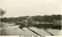 McCarthy Album 09, Photograph 127 Caption: "St. Lawrence River Scene," c. 1925. This photograph looks across the Saint Lawrence River toward a large house and wooded area on the far bank.
 -
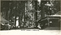 McCarthy Album 09, Photograph 254 Caption: "Camp Curry- Yosemite," c. 1917. Yosemite's Half Dome Village, established by David and Jennie Curry in 1899, was originally called Camp Curry, and later Curry Village. It was designed to provide cheaper accommodations for Yosemite tourists than the resort hotels. The couple rented out furnished tents and provided amenities such as a dining tent. As time progressed, the amenities increased, and some hard-sided cabins created. This photograph shows a bustling scene around a large wood cabin with a wide covered porch. As a result of a legal dispute over trademarked names in the park, Curry Village changed its name to Half Dome Village in 2016.
 -
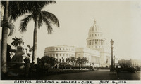 McCarthy Album 11, Photograph 117 Caption: "Capitol Building -- Havana -- Cuba. July 4, 1934." The building seen in this photograph, reminiscent of the U.S. Capitol, served as Cuba's Capitol from its completion in 1929 until after the Cuban Revolution of 1959. Designed by Eugenio Rayneri Piedra, the building now houses the Cuban Academy of Sciences.
 -
 McCarthy Album 04, Photograph 056 Caption: "Tioga Lake." Glacial lake in the Sierra Nevada Mountains, in Mono County, California, within the Inyo National Forest.
 -
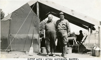 McCarthy Album 04, Photograph 183 Caption: "Camp Life -- Utah National Guard.," c. 1915-1920. Two Utah National Guardsmen standing in front of tent at an unidentified location.
 -
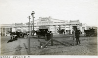 McCarthy Album 05, Photograph 111 Caption: "Ocean Beach, S.F.," c. 1910. Scene at Ocean Beach, San Francisco, with eating establishment Murray's in the background. The photograph features both motor car and horse-and-buggy transportation methods.
 -
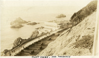 McCarthy Album 09, Photograph 001 Caption: "Cliff House, San Francisco," c. 1920. The building shown here is the fourth iteration of the Cliff House, a neo-classical design built after a fire destroyed the Victorian structure previously at the site in 1907. Reconstruction of the iconic restaurant began in 1908, and a new Cliff House opened in 1909 (the building in this photograph). The building was extensively remodeled in the 1930s.
 -
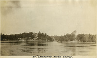 McCarthy Album 09, Photograph 128 Caption: "St. Lawrence River Scene," c. 1925. This photograph looks across the Saint Lawrence River toward two large houses on the far bank. One of the houses may be on a small island.
 -
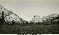 McCarthy Album 04, Photograph 057 Caption: "Mountain Scene -- Tenaya Lake." Meadow with surrounding rocks and mountains. Named after Chief Tenaya of Yosemite Valley's Ahwahnechee People, Tenaya Lake is located between Yosemite Valley and Tuolumne Meadows within Yosemite National Park. The surface elevation of the alpine lake is 8,150 feet.
 -
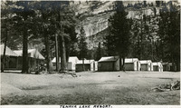 McCarthy Album 04, Photograph 058 Caption: "Tenaya Lake Resort." Small cabins in front of rocky mountainside. Named after Chief Tenaya of Yosemite Valley's Ahwahnechee People, Tenaya Lake is located between Yosemite Valley and Tuolumne Meadows within Yosemite National Park. The surface elevation of the alpine lake is 8,150 feet.
 -
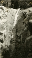 McCarthy Album 04, Photograph 185 No caption, c. 1915-1920. Petrified tree trunk partially buried at unidentified location.